In this article:
This is the third of a five-part series from our December 2025 trip to the United States. After New York and Washington D.C., our trip shifted westward to the desert, and the change in scenery could not have been more dramatic.
Prologue
Las Vegas would serve as our base for exploring the American Southwest. While it is best known for casinos and neon lights, it also sits within driving distance of some of the most dramatic landscapes in the United States. The Grand Canyon, Antelope Canyon, and Horseshoe Bend were all on the list.
Trip planning
Las Vegas itself is fairly easy to navigate. The Strip is compact, and most of the major hotels cluster along the same stretch of Las Vegas Boulevard.
The bigger planning effort was for the desert excursions. The Grand Canyon alone has multiple access points, and each offers a very different experience.
For this trip we booked two tours through Klook. The bookings ended up slightly cheaper than going direct, especially after applying a bank-issued promo code. One tour was operated by Gray Line Tours for the Grand Canyon West Rim, while the other was run by National Park Express for our trip to Antelope Canyon and Horseshoe Bend.
We had originally planned to visit the Grand Canyon South Rim, which is widely regarded as the most scenic part of the canyon. I had actually visited the South Rim back in 2022 and absolutely loved it. The scale and viewpoints there are spectacular, and it was something I was looking forward to showing my partner this time around.
Unfortunately the South Rim tour was cancelled and we were instead “upgraded” to the West Rim. The West Rim is much closer to Las Vegas, significantly more commercialised, and far easier to run as a day trip. I suspect Christmas Day made the logistics less appealing for the operator. Not quite what we had planned, but we decided to roll with it.
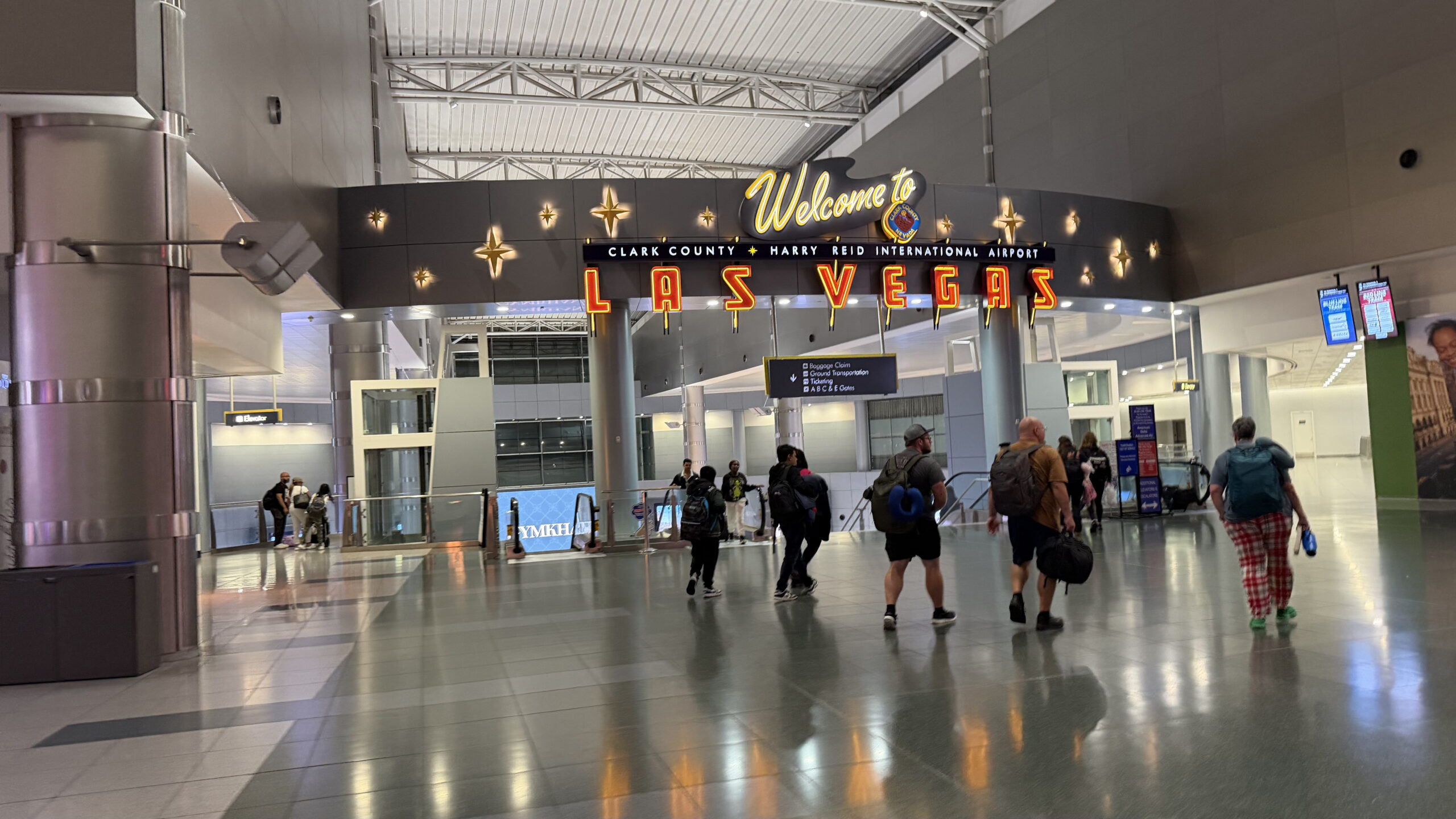
Arrival at Harry Reid International Airport
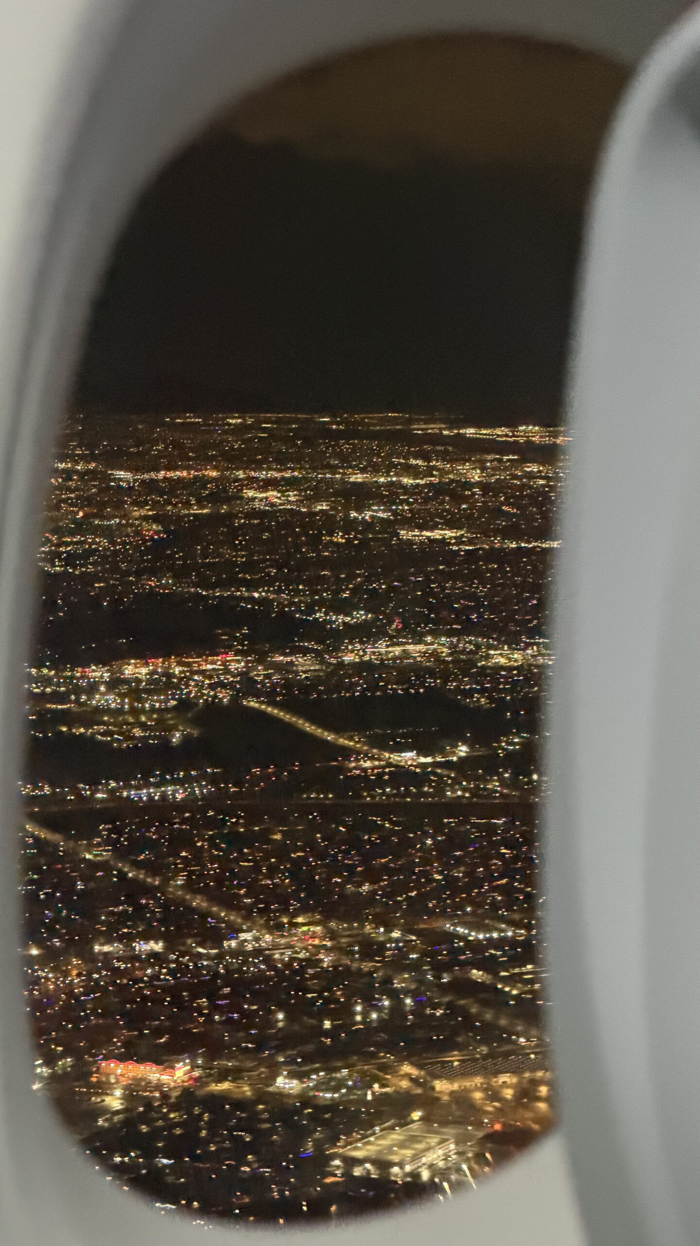
Our flight landed at Harry Reid International Airport. My previous visit to Las Vegas was back in 2022, when the airport was still called McCarran International Airport. It has since been renamed Harry Reid International Airport, though inside, things feel largely the same.
The airport sits surprisingly close to the Strip. Within minutes of leaving the terminal, the skyline of the casino hotels is already in view. There is almost no transition between landing and being in Las Vegas.
We booked an Uber and headed straight to our hotel, the Horseshoe Las Vegas, right on the Strip. It was a late arrival, and we were pretty much done for the day.
Day 1: Hoover Dam and Grand Canyon West Rim
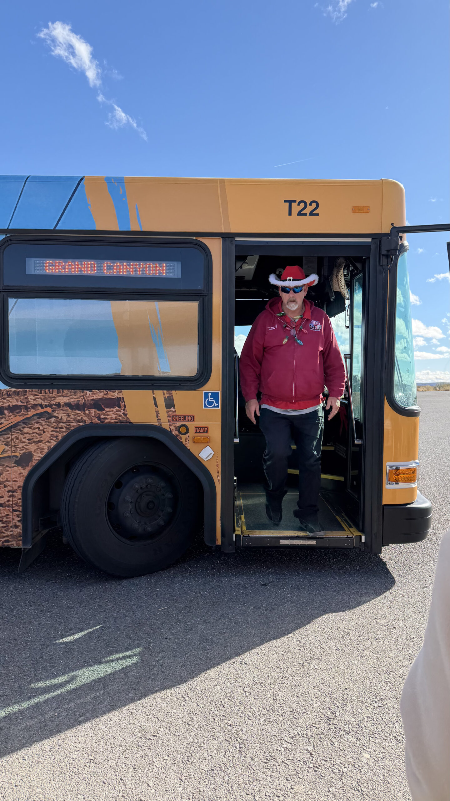
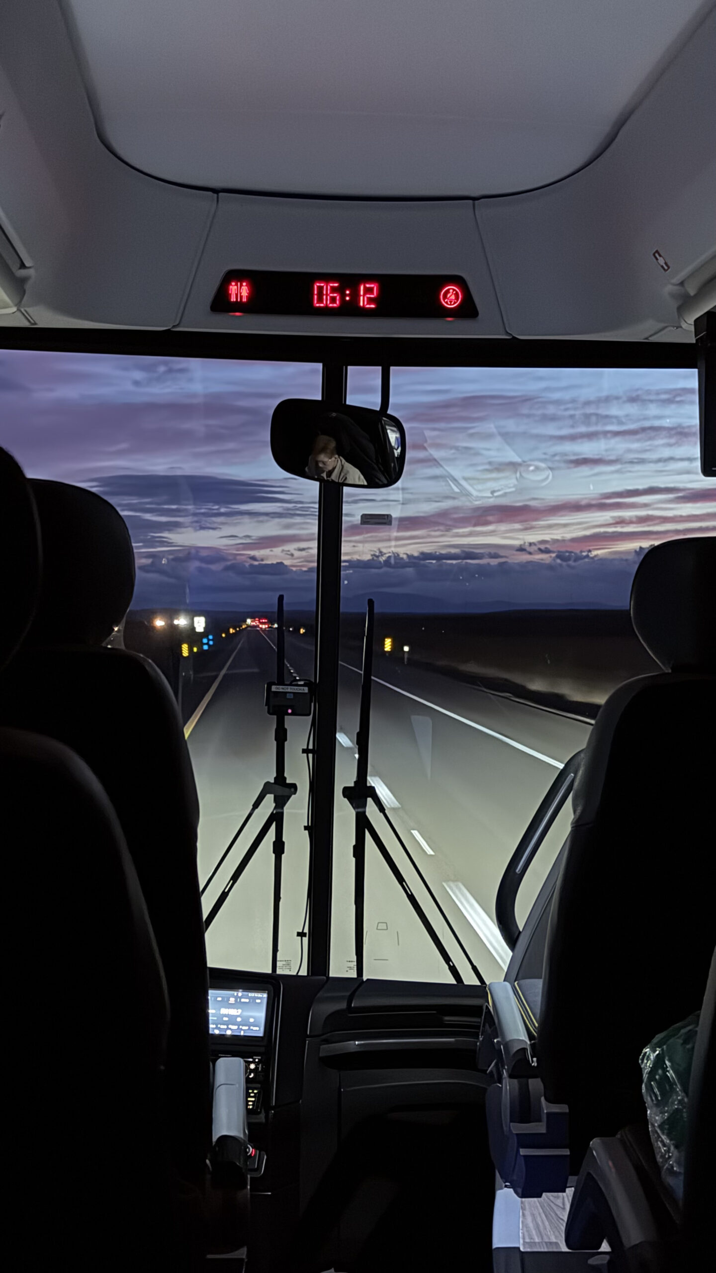
Our Grand Canyon day trip started early in the morning, at around 5.15am. We had our pickup point right at our doorstep, which partly influenced why we picked Horseshoe Las Vegas. It took a while for the tour operator to pick people up across multiple hotels before we headed straight to our first stop.
The Hoover Dam
The first stop was Hoover Dam, one of the most famous engineering projects in the United States. Built during the Great Depression in the 1930s, the dam was a monumental undertaking for its time.
It harnesses the Colorado River and supplies water and hydroelectric power to several states across the Southwest. Standing on it gives you a sense of scale that photos rarely capture.
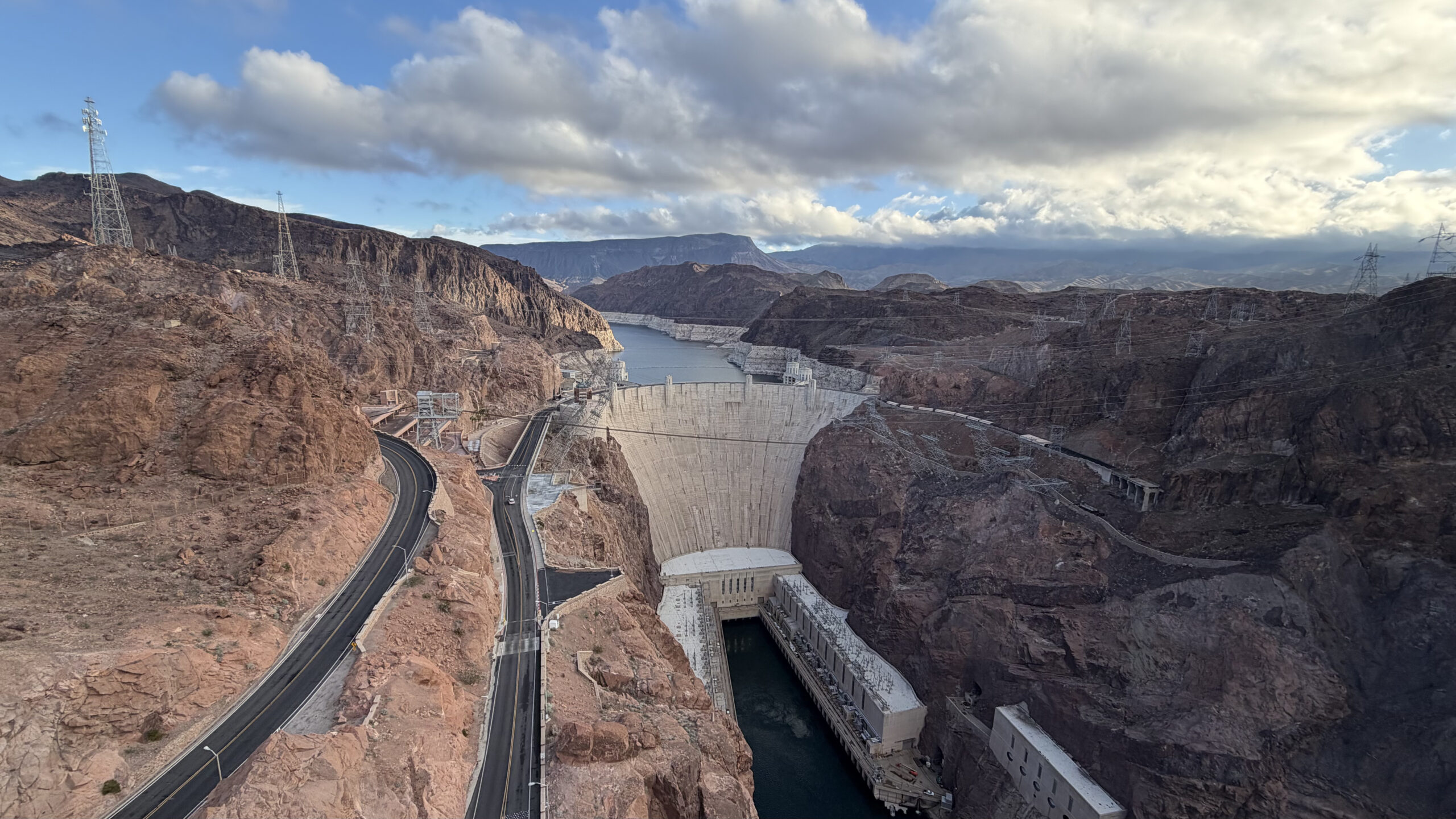
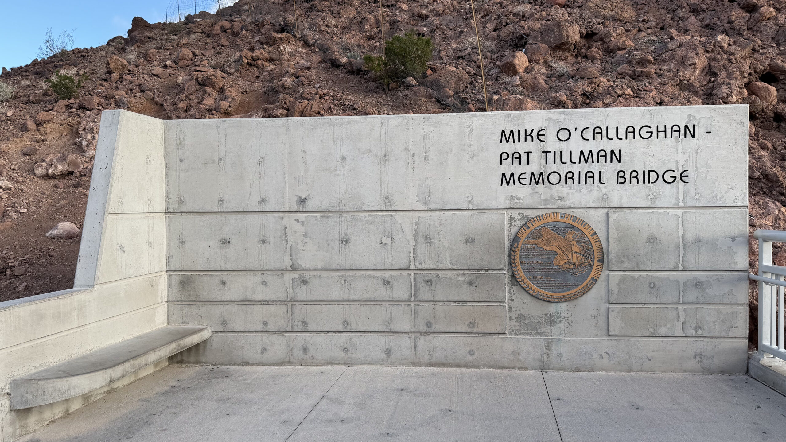
Nearby, the Mike O’Callaghan-Pat Tillman Memorial Bridge spans the Colorado River and offers sweeping views of the dam from above.
One small detail: the Nevada-Arizona state line runs right across the dam. You can stand in two states at once.
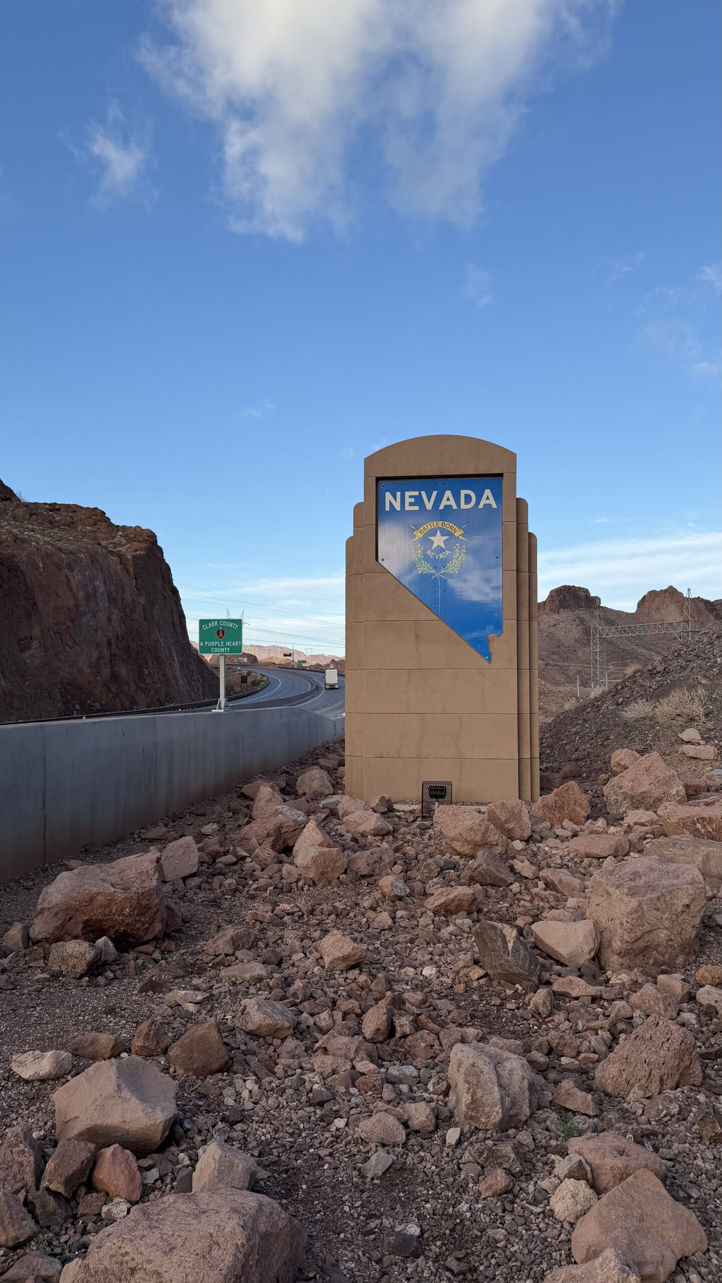
Getting to the Grand Canyon West Rim
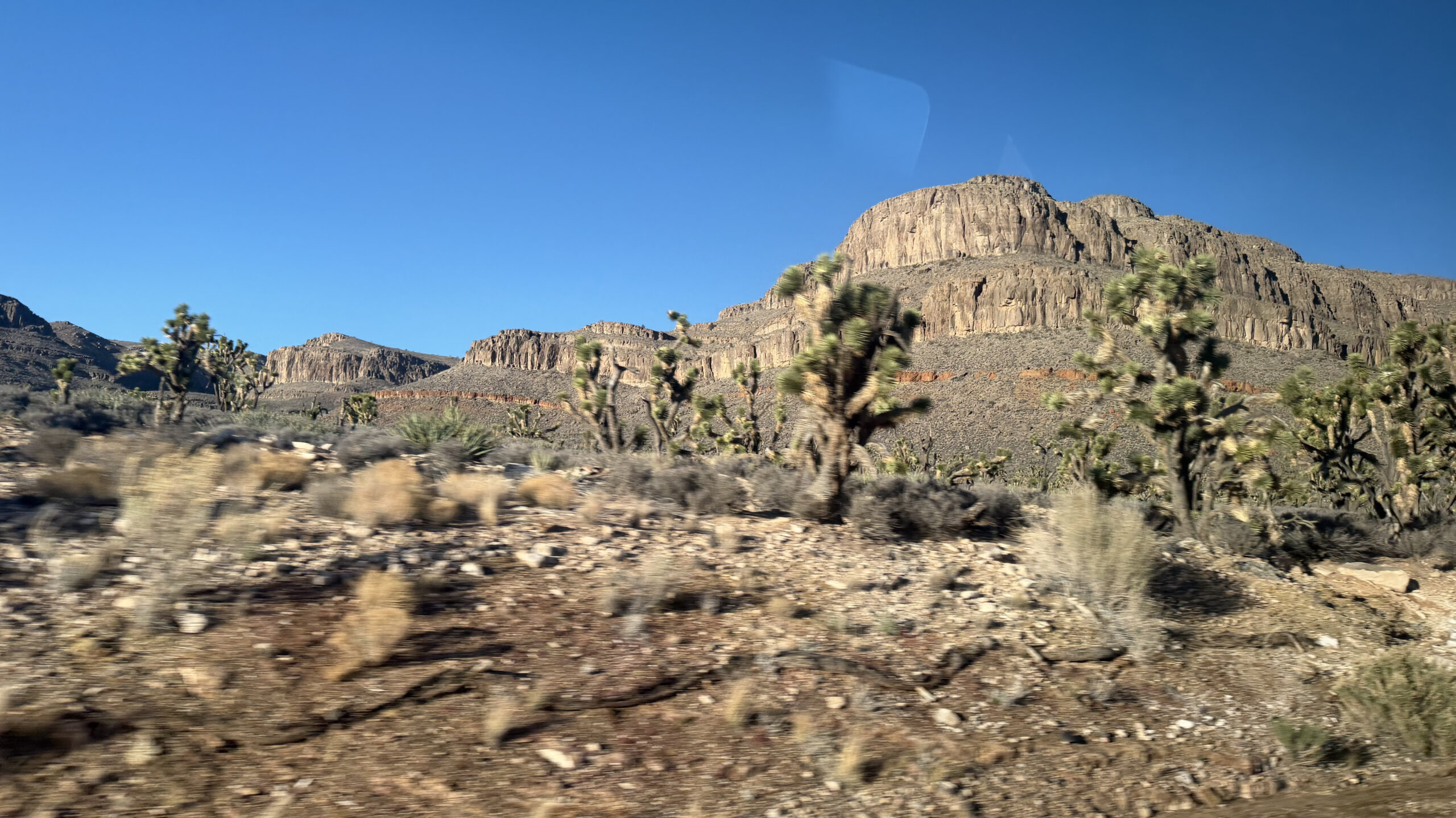
As we continued towards the Grand Canyon, the landscape changed completely. The highways stretched out into the desert with almost nothing around. Rocky terrain, the occasional Joshua tree, and a lot of empty sky.
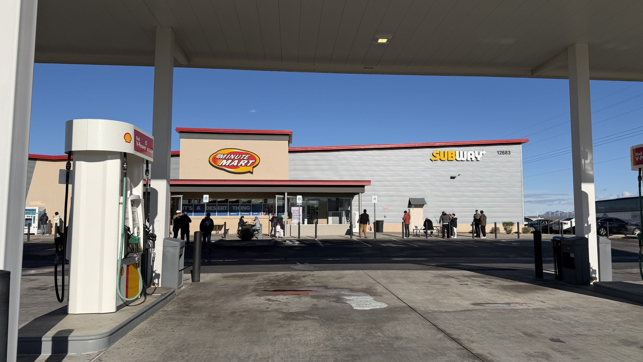
We stopped briefly at a roadside Minute Mart, one of those small outposts of fuel, snacks, and supplies that are scattered across the American West. These kinds of stops are a reminder of just how vast and empty some parts of the country are.
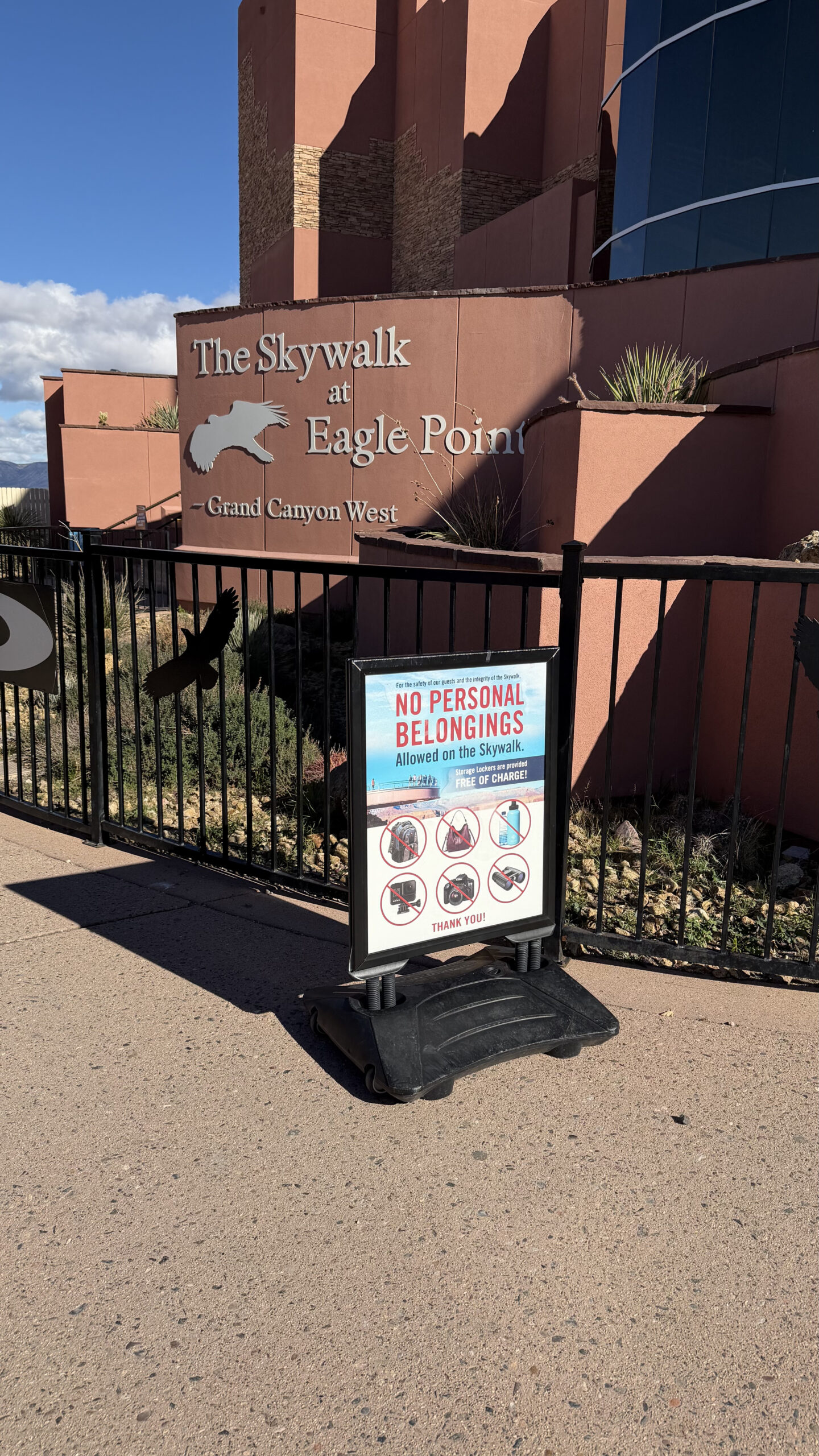
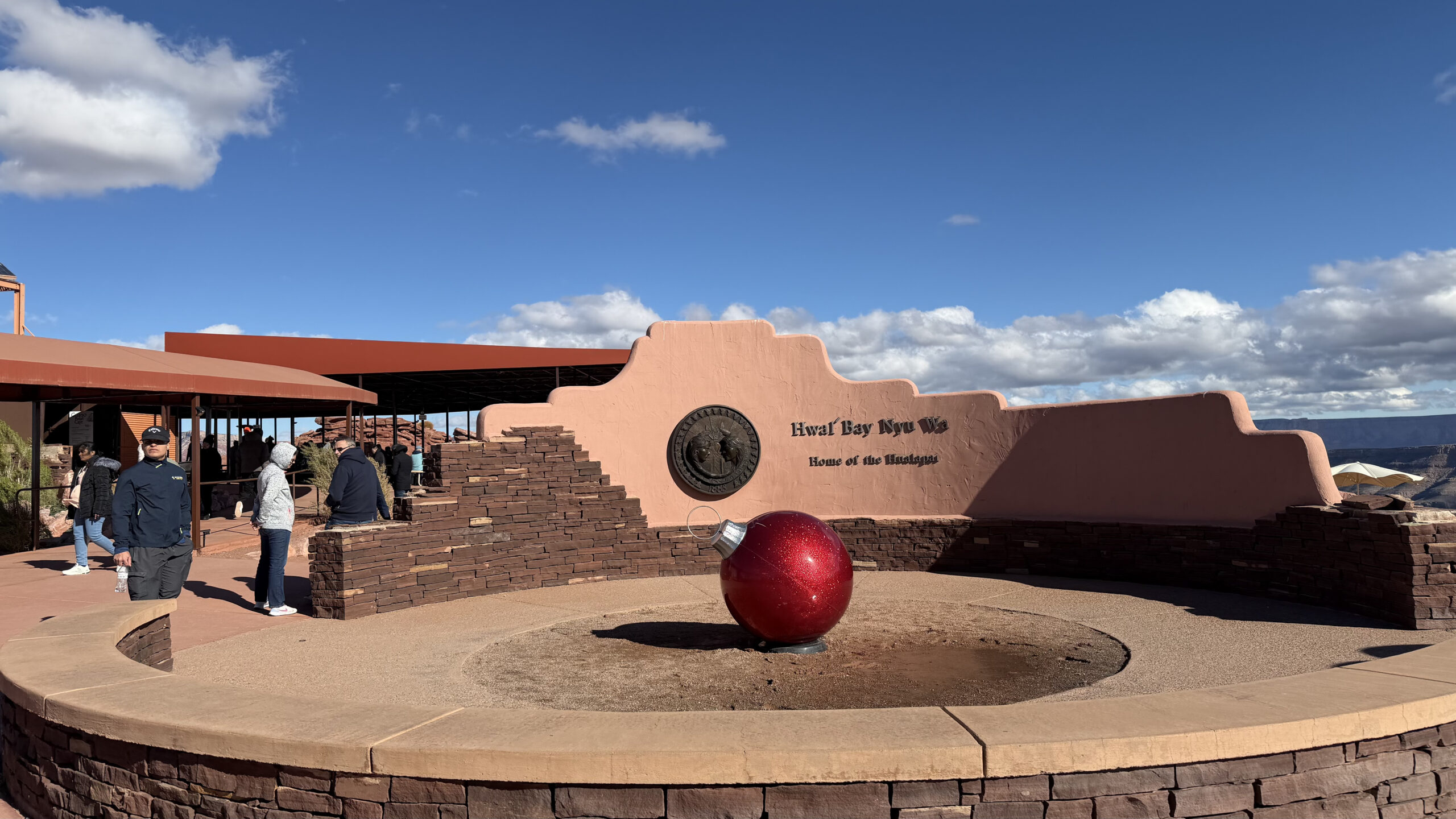
We finally reached the Grand Canyon West Rim’s Visitor Centre. Before entering the main area, visitors pass through a checkpoint and basic security screening. The visitor complex inside has gift shops, orientation displays, and boarding areas for shuttle buses.
The West Rim operates a shuttle system between viewpoints, and private vehicles are not allowed beyond the entrance. It is well organised, though the setup does feel more like a managed tourist experience than a national park.
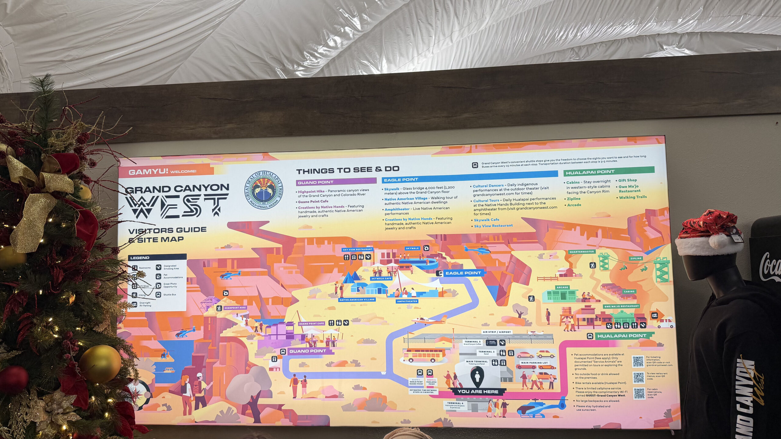
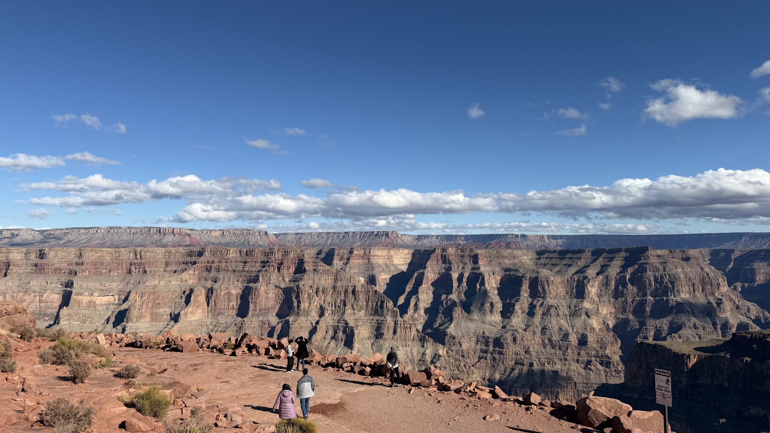
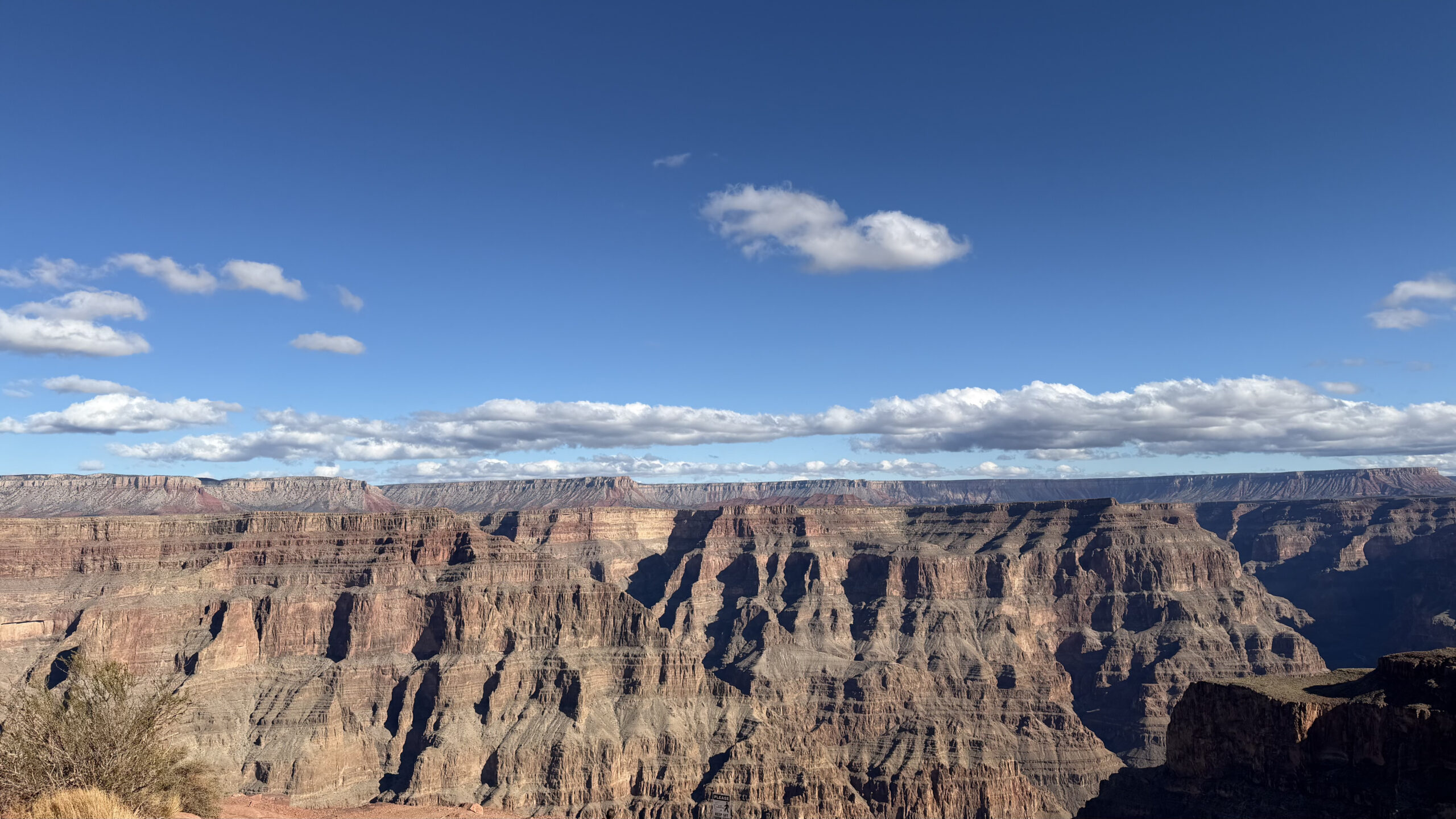
Eagle Point
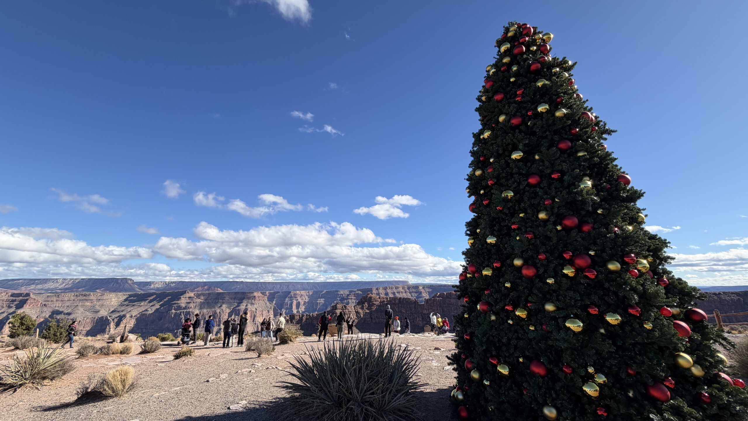
Our first stop was Eagle Point, named after a rock formation along the canyon rim that resembles an eagle with its wings spread.
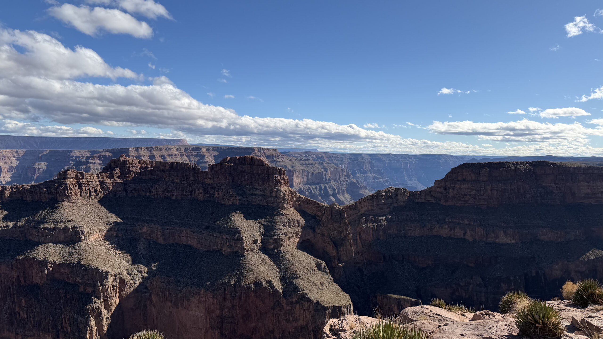
The canyon views were impressive, and the cliffs stretch out in layered formations that feel almost unreal in person. No amount of photos really prepares you for the depth of it.
It was also the holiday season, and there was a Christmas tree near the viewpoint. A slightly odd but memorable sight against the desert backdrop.
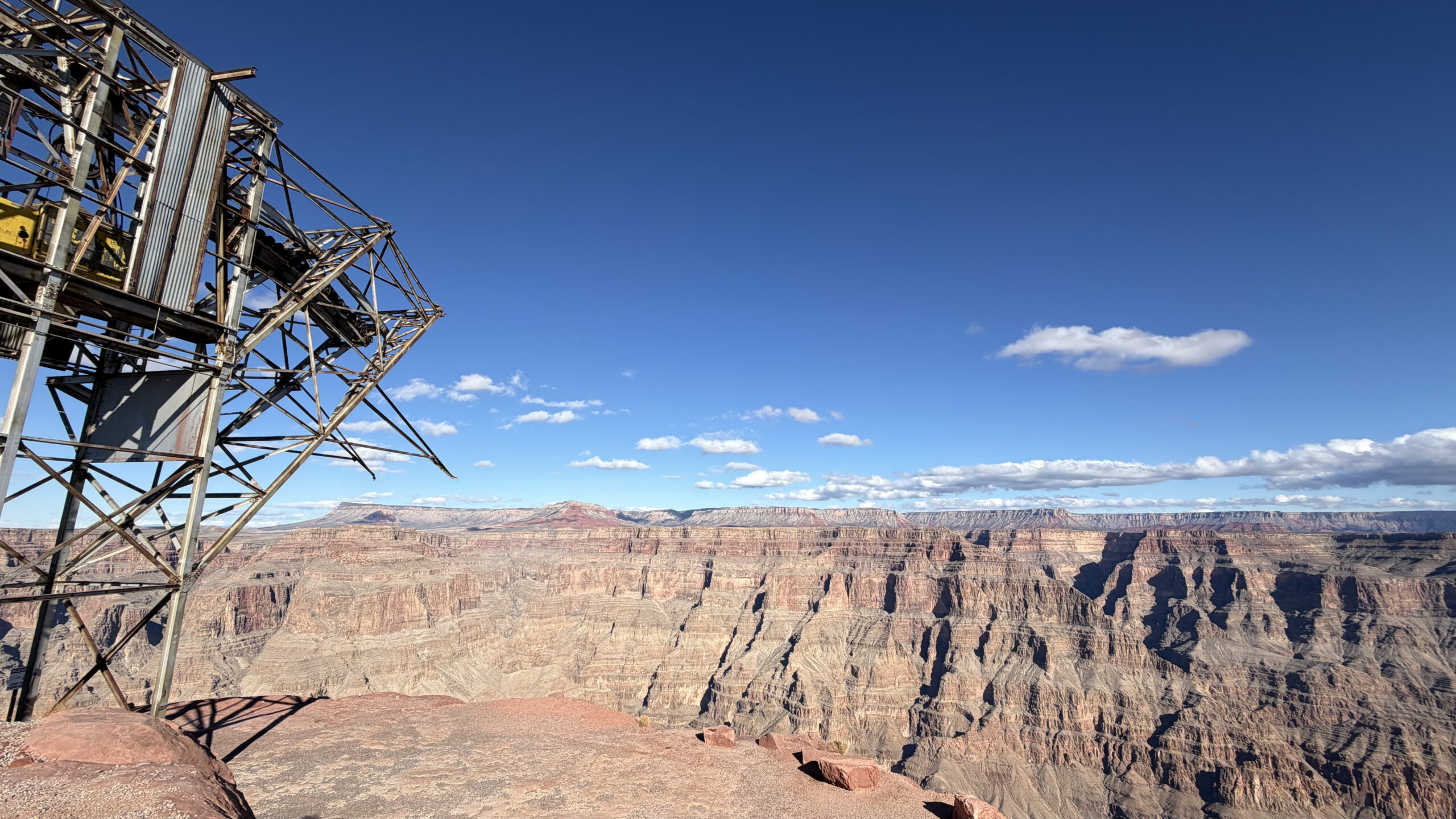
Guano Point
Next, we took the shuttle to Guano Point.
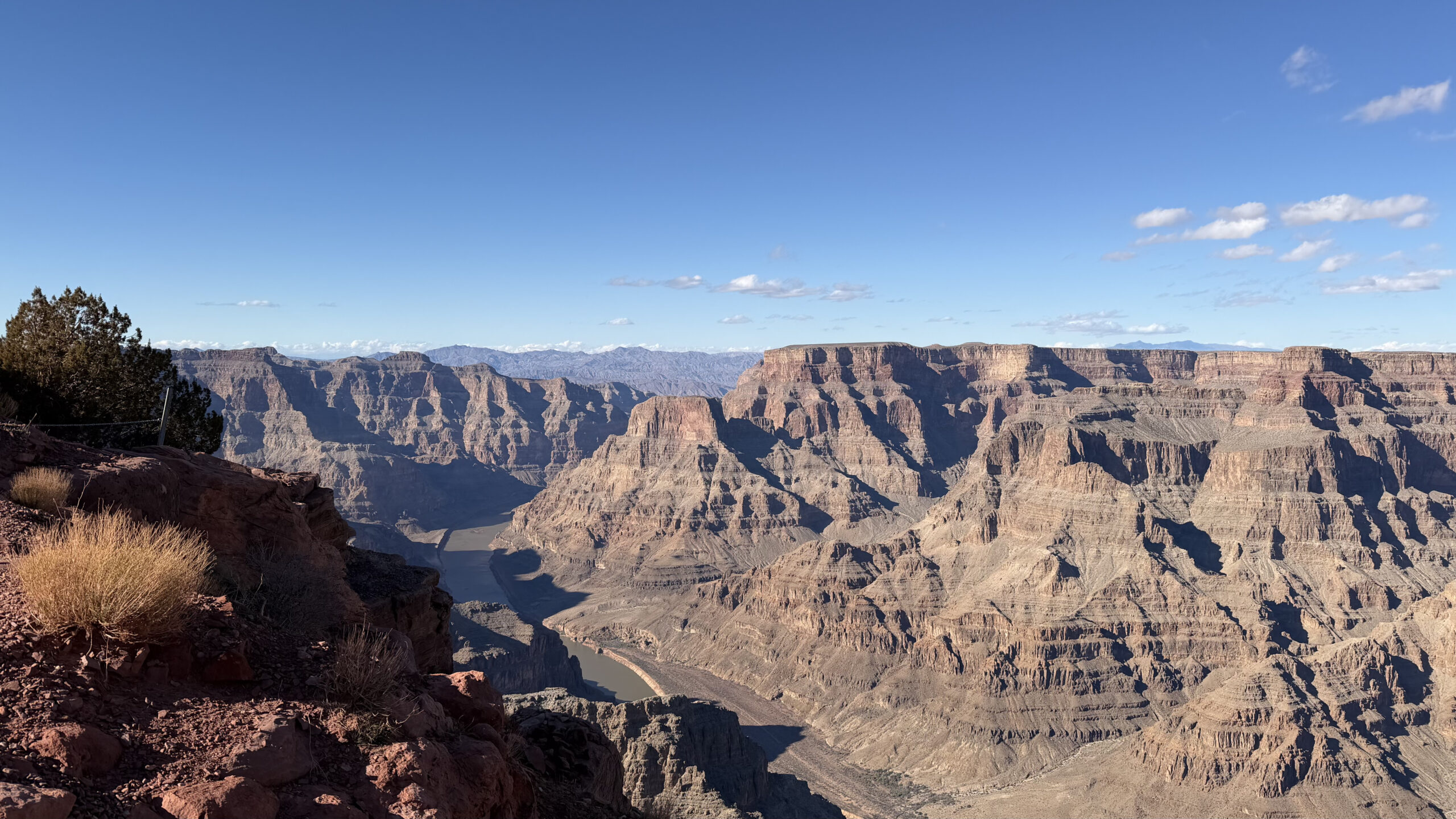
This was the highlight of the West Rim for us. Guano Point offers some of the most open views along the canyon, with the Colorado River visible far below.
We hiked up to the remnants of an old tramway station that once supported a 1950s bat guano mining operation. The rusted structures are still scattered along the ridge. A strange piece of industrial history sitting in the middle of all that natural scenery.
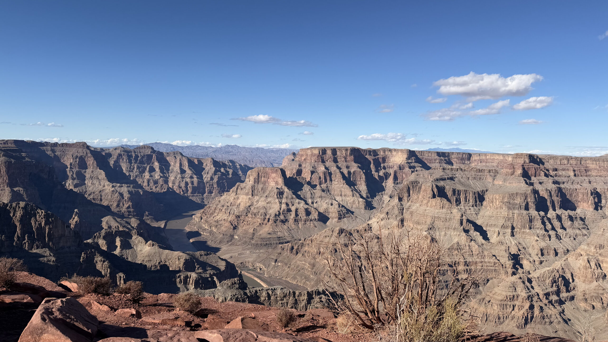
The hike up takes about 15 to 20 minutes. The way down is much easier. From the top, the view opens up properly. The Colorado River winding through the canyon, the layered cliffs stretching out. The scale of it is hard to take in.
Even with the West Rim being the more commercialised option, views like this made the trip worth it.
After that, it was back to Las Vegas, which took about 2.5 hours including a rest stop at the Minute Mart. Having now been to both rims of the Grand Canyon, I would highly recommend the South Rim if you have the time. Much better experience overall.
Day 2: Horseshoe Bend and Antelope Canyon X
Another day, another early start. This tour is operated by National Park Express, who generally run much better tours with good price points too.
We drove along Interstate 15 towards Utah, and the scenery shifted again from city to open desert. We passed through Colorado City in Arizona before reaching our next stops.
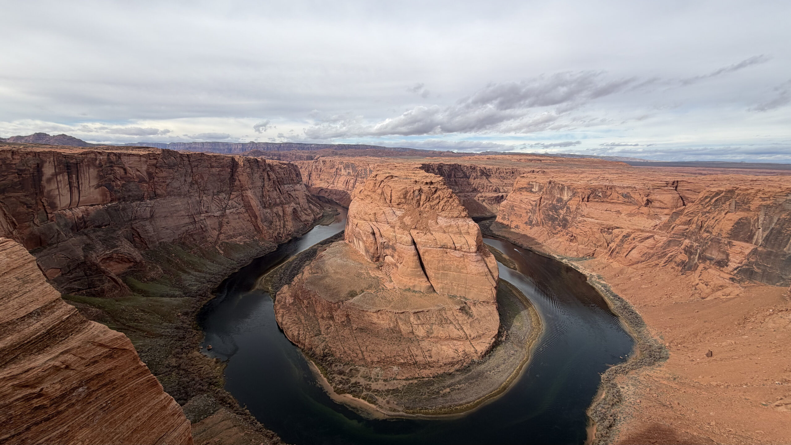
Horseshoe Bend
The Horseshoe Bend is one of the most recognisable viewpoints in the region, and it is easy to see why.
From the cliff edge, the Colorado River curves into a dramatic horseshoe shape far below. The walk to the overlook is short and manageable, though the drop at the edge is steep. If you are not great with heights, you will feel it.
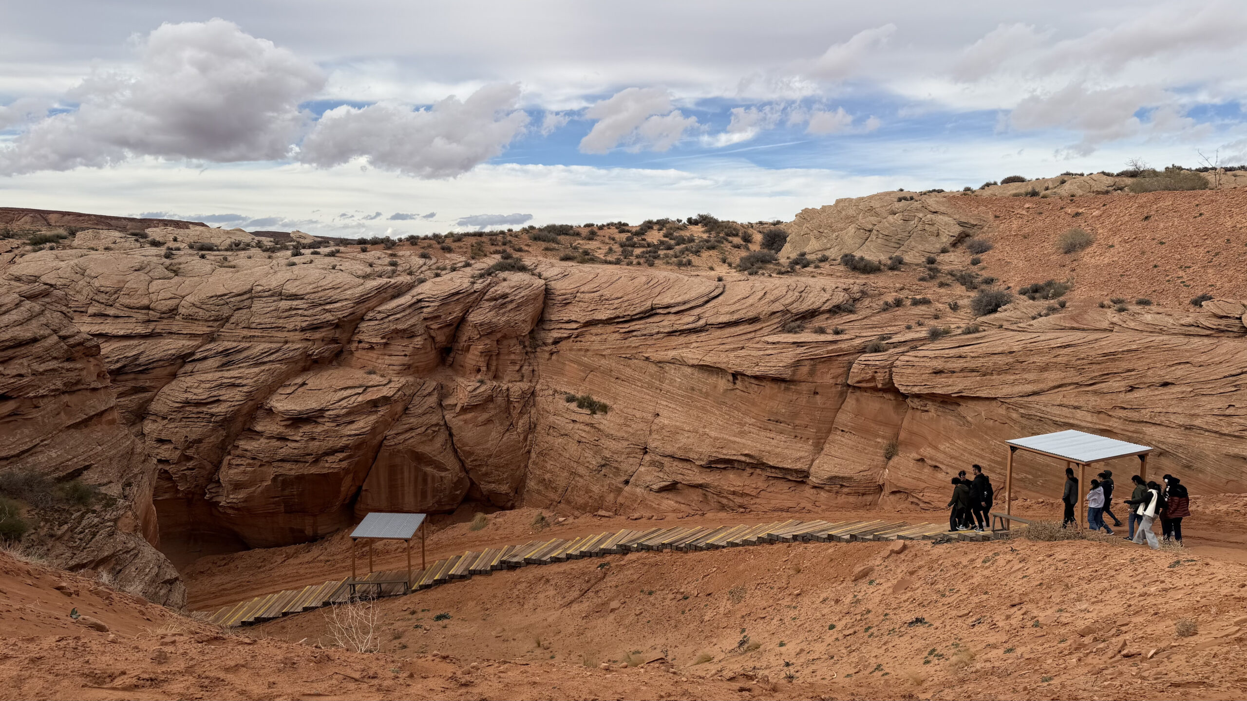
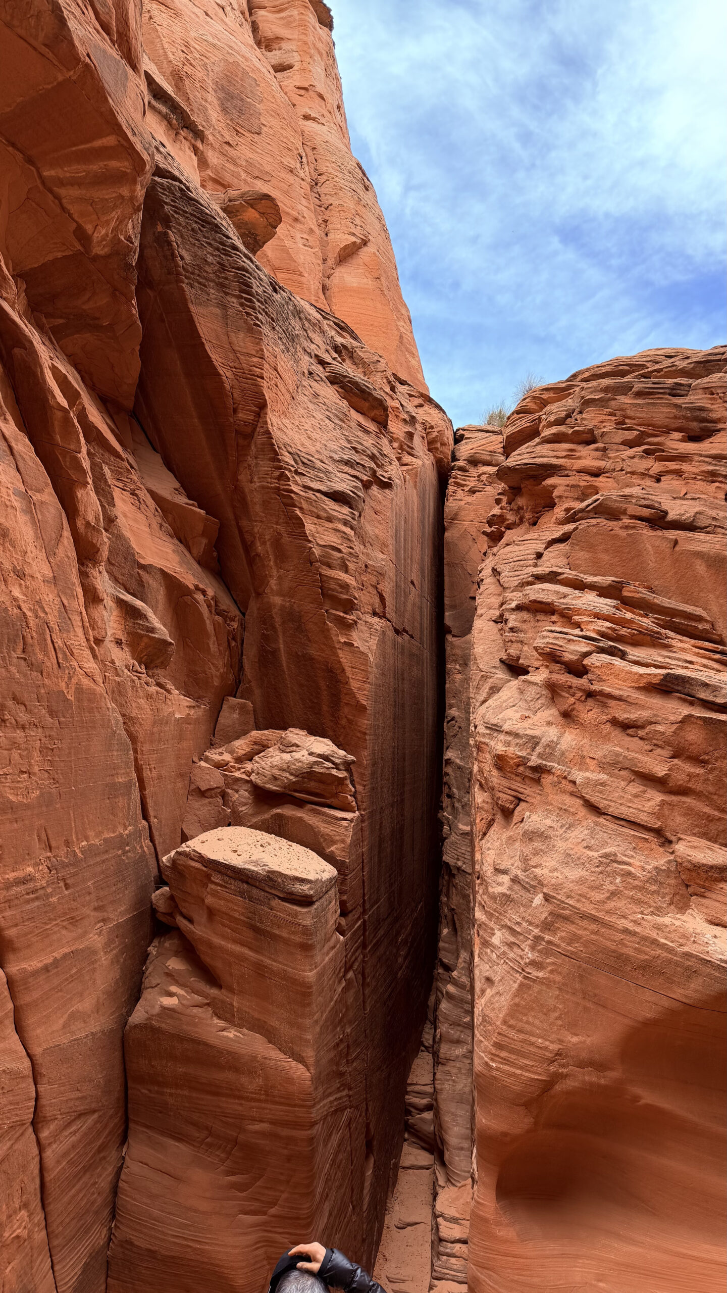
Antelope Canyon X
Our tour brought us out to the Antelope Canyon area, where visitors split off depending on which canyon they had booked. Some went to Lower, others to Upper. We had booked Antelope Canyon X.
Antelope Canyon is famous partly because of the stock wallpaper that shipped with macOS. That image was captured at Upper Antelope Canyon.
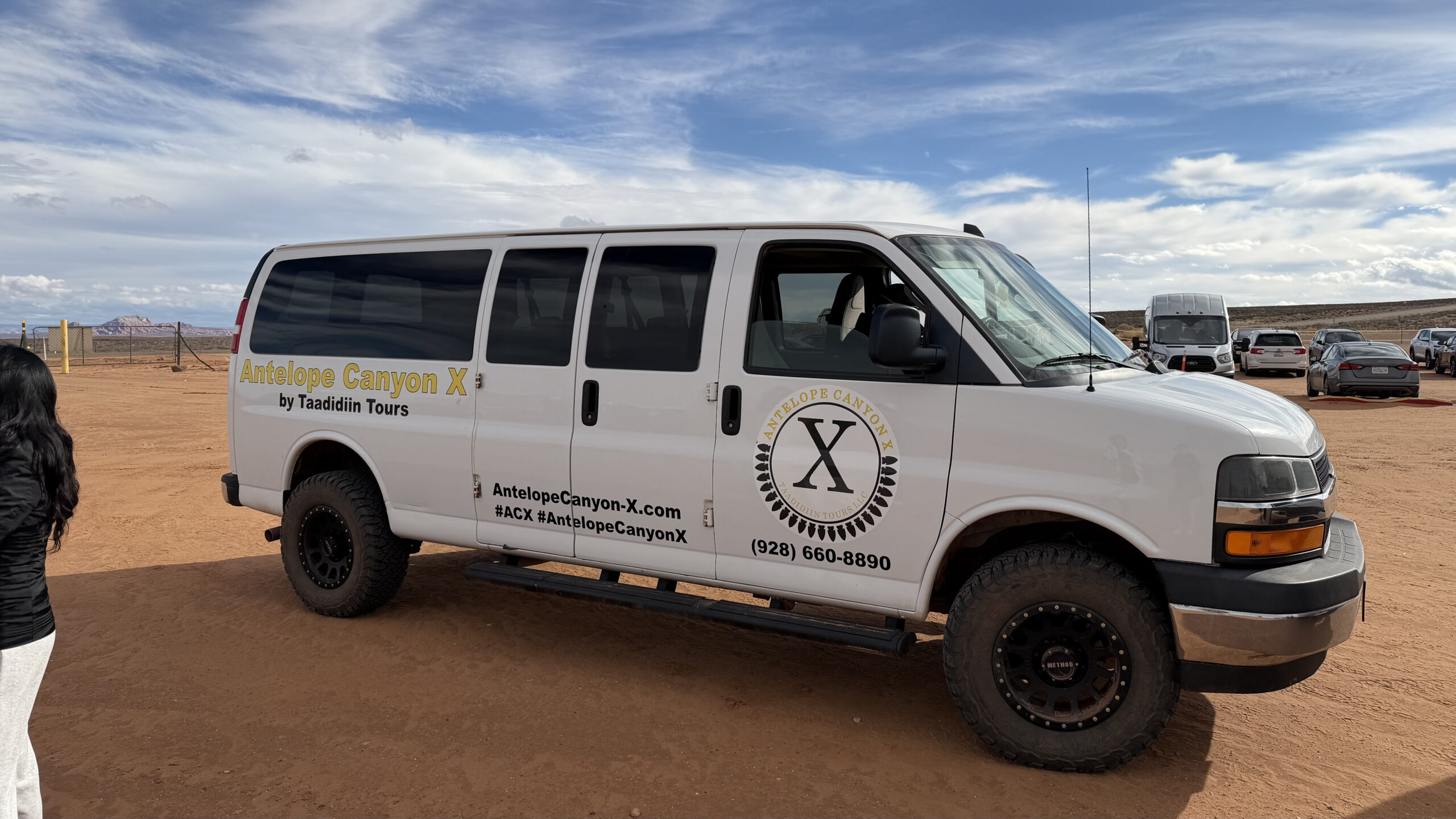
We were then dropped off at our check-in spot, and from there took a van out to the actual canyon site.
Once there, we descended into the canyon floor through a winding path down.
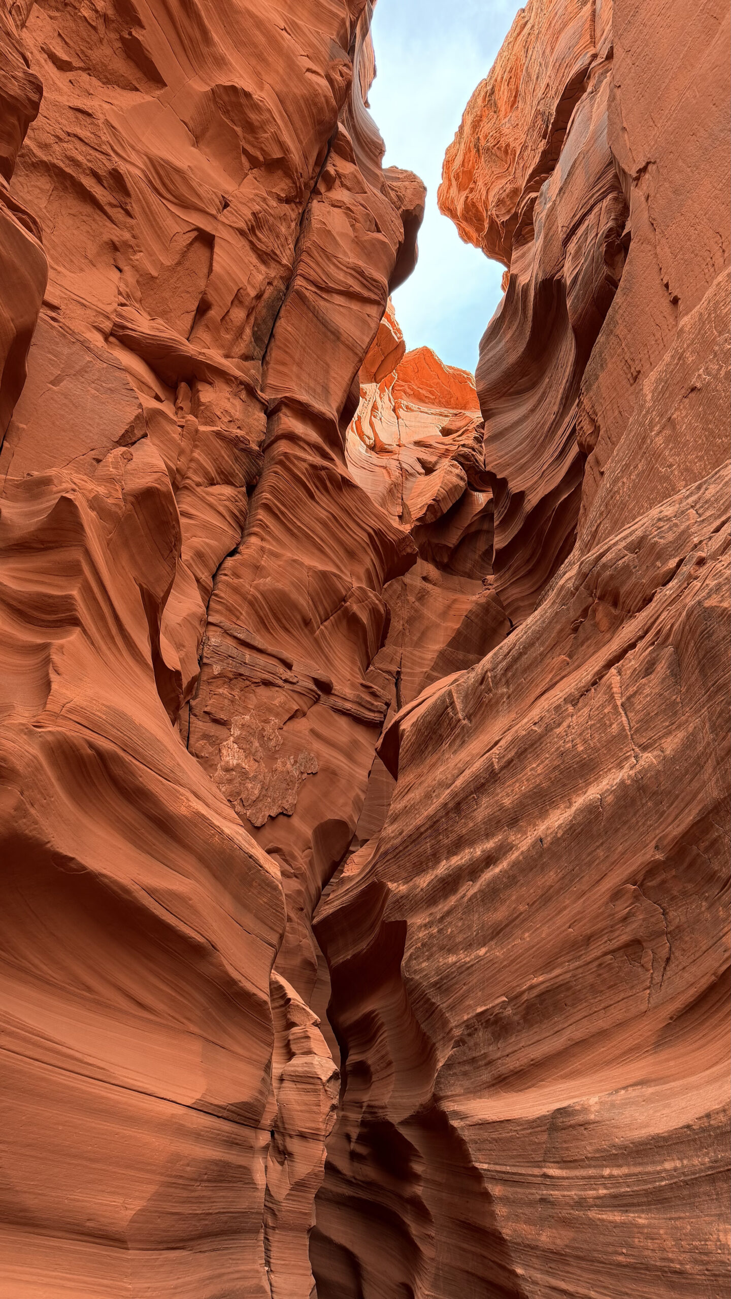
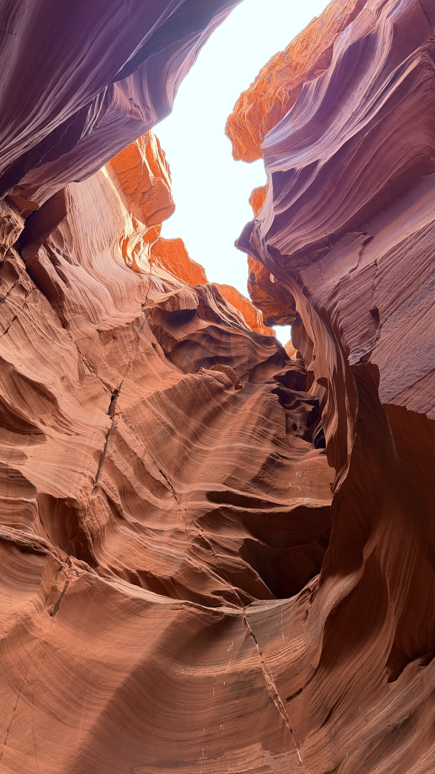
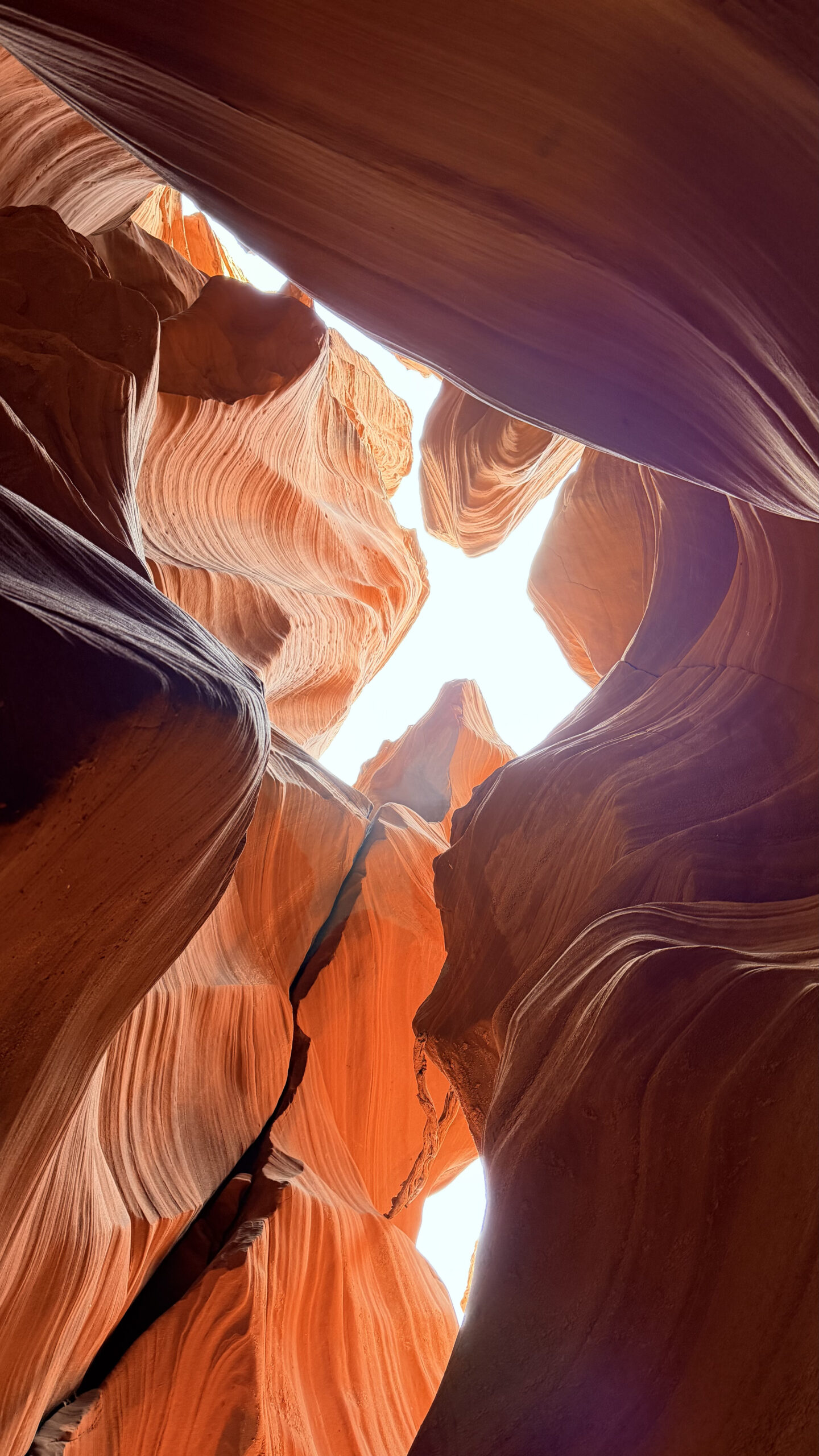
Slot canyons like this are formed over thousands of years as flash floods carve narrow passageways through the sandstone.
Inside, the walls twist and curve in flowing shapes. Light comes through the openings above, creating shifting patterns across the rock. The colours range from deep red to soft orange depending on how the sunlight hits the walls.
Antelope Canyon X is quite different from the more well-known Lower and Upper Antelope Canyon. I was told that Lower Antelope Canyon can be pretty hectic, with 30-minute time slots and large crowds cycling through.
Canyon X, by contrast, gives you a full hour per slot. It is far less cramped, and the whole experience feels more relaxed.
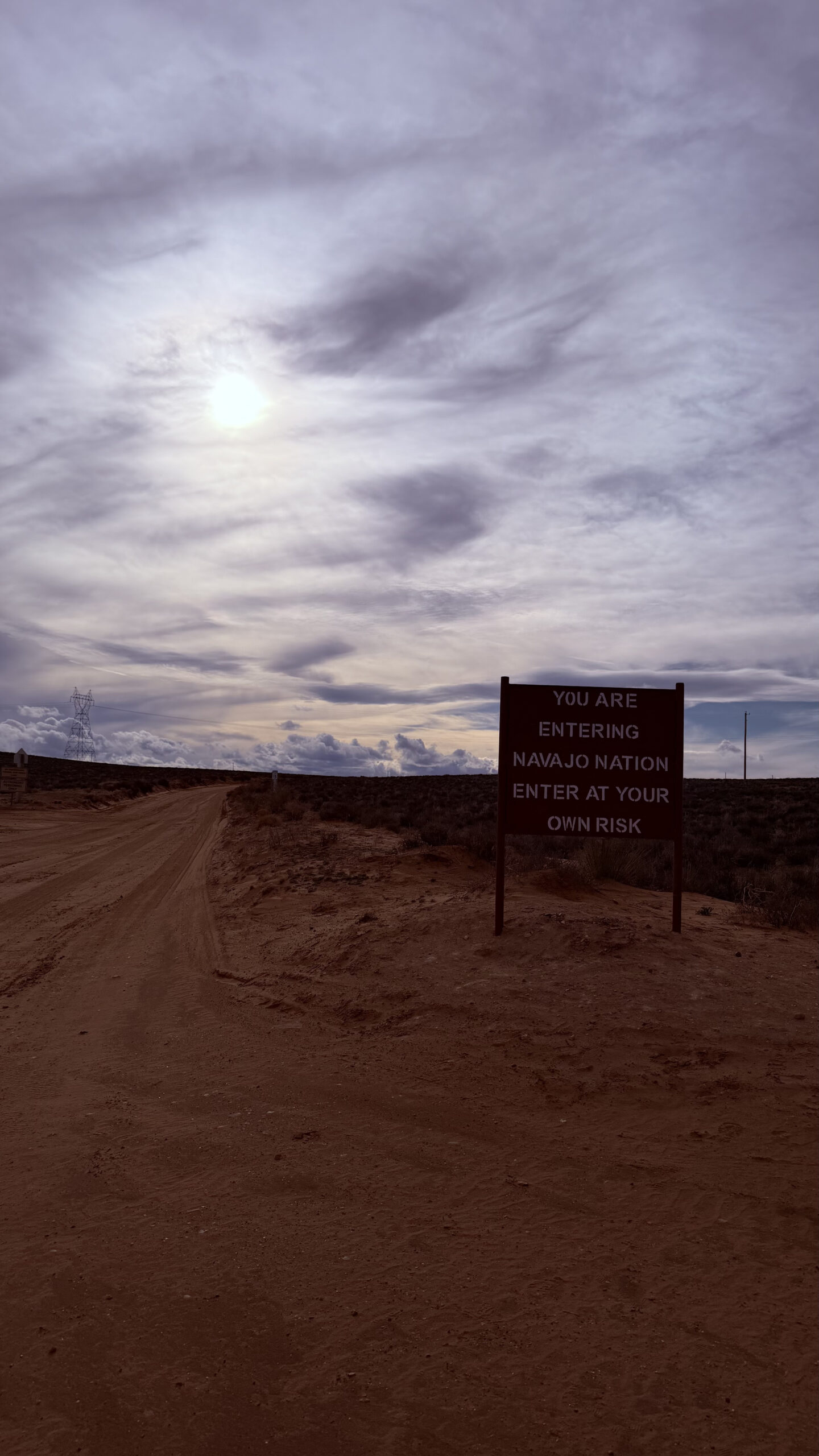
The tours are guided by Navajo people, and it is all within the Navajo Nation. This was actually my second time visiting, and I would go again. For the price point, it is amazing.
Easily one of the most photogenic landscapes in the American Southwest, and the kind of place where even casual photos come out looking incredible.
That was pretty much the whole journey. We spent about 90 minutes here in total, and didn’t come out feeling rushed. Would absolutely recommend the Antelope Canyon X.
Exploring the Strip
Back in Las Vegas, we spent some time walking the Strip and checking out the hotels.
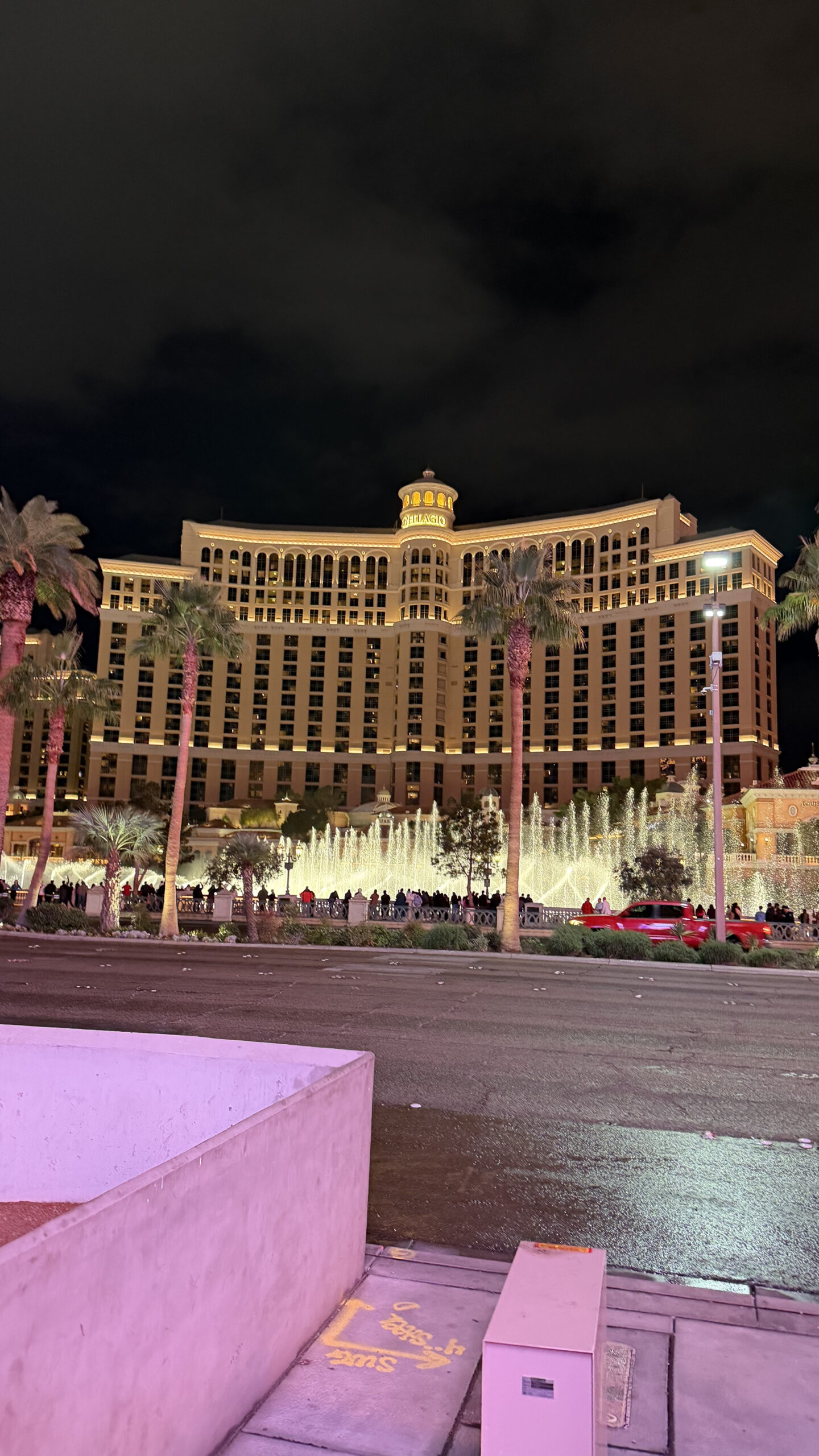
We stayed at Horseshoe Las Vegas, which used to be known as Bally’s. The location is great. It sits right across from the Bellagio, so we had a direct view of the Bellagio fountains.
The fountain show at night is still one of the classic Las Vegas experiences. The choreography, lighting, and music are well done, and even after multiple visits it still pulls a crowd.
We walked through the Bellagio Conservatory & Botanical Gardens, which was decorated for Christmas with elaborate floral displays and seasonal installations. Free to visit and always worth a look.

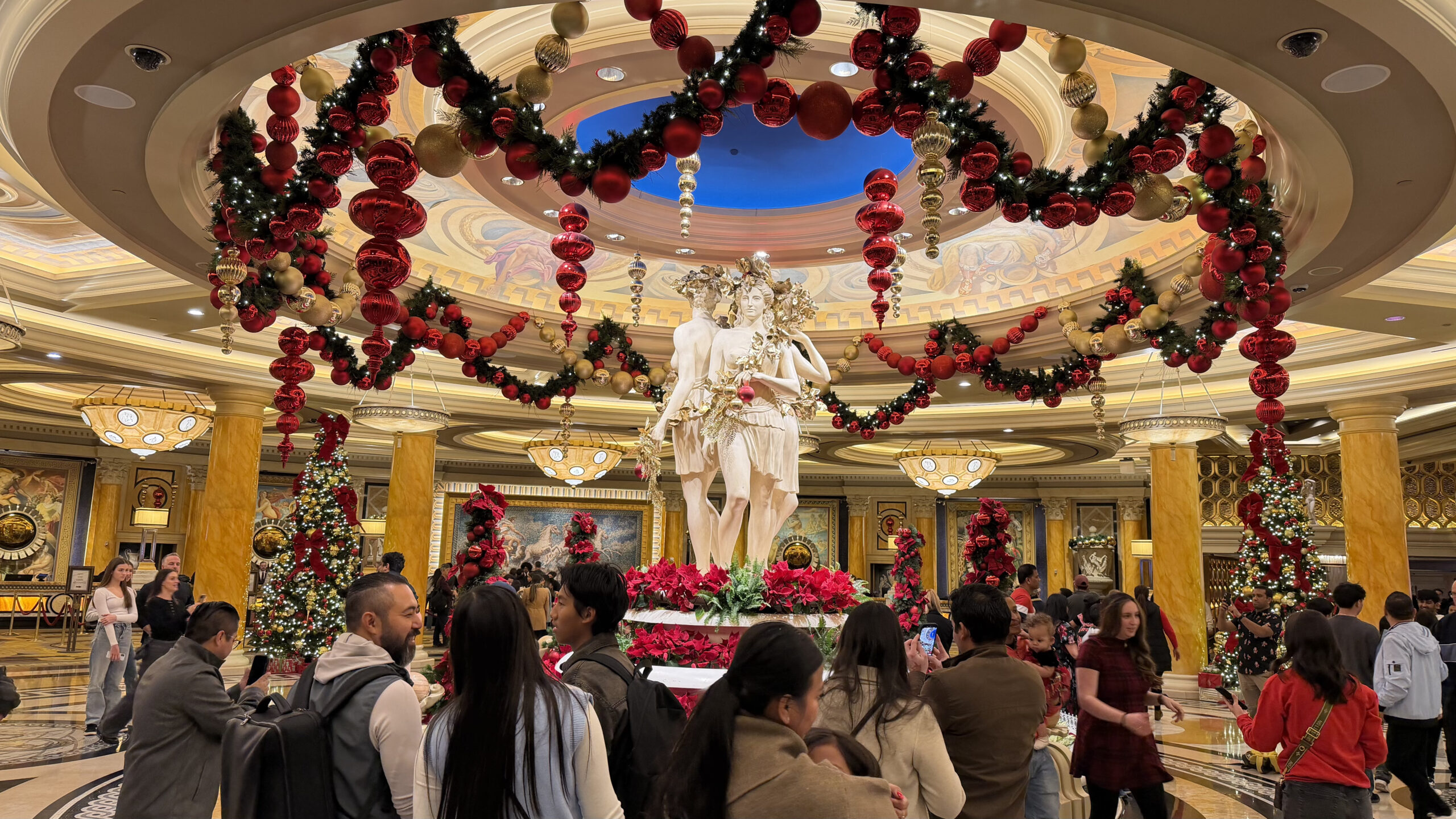
Caesars Palace was its usual self. Roman-themed grandeur turned up as high as it will go.
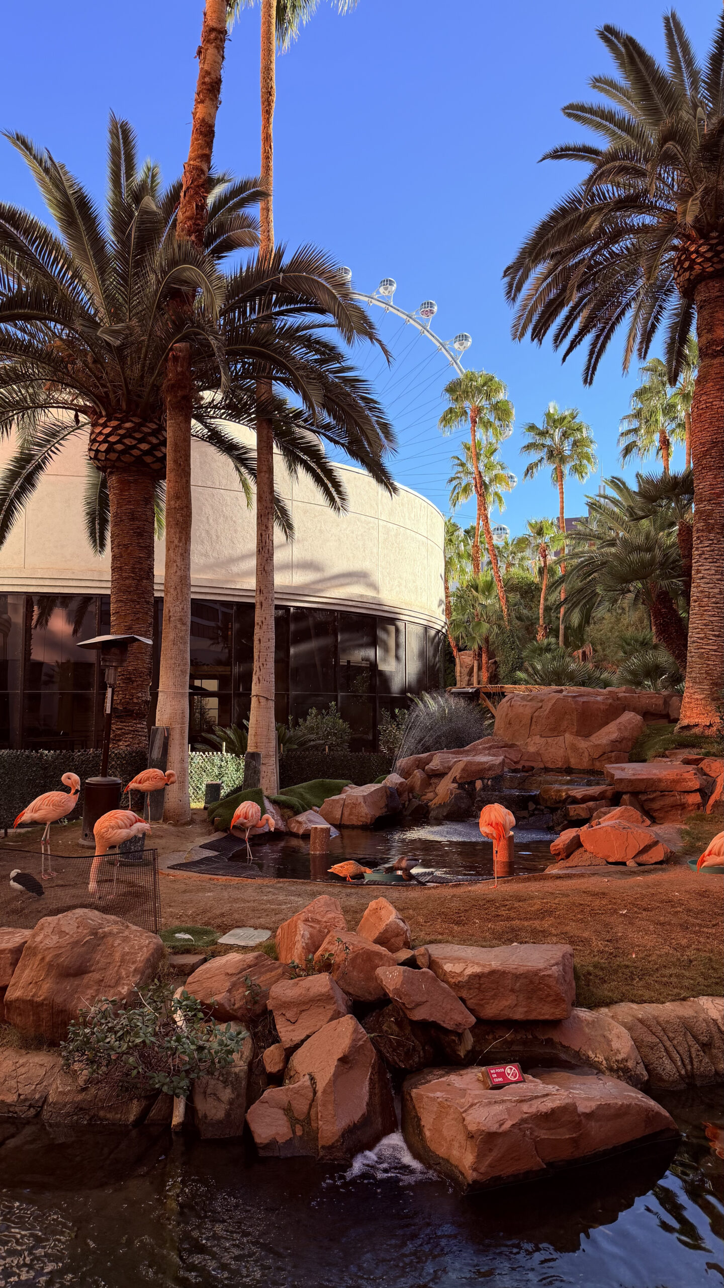
The flamingo habitat at The Flamingo is one of the more unusual spots on the Strip. Live flamingos wandering around a small tropical garden right in the middle of the casino complex. A bit absurd, but fun.
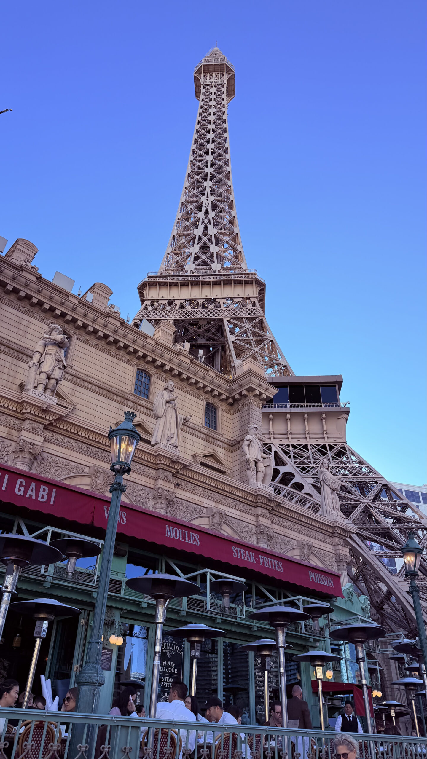
Further along, Paris Las Vegas stands out with its replica Eiffel Tower rising above the surrounding buildings. Kitschy, but it adds to the Strip’s general spectacle.
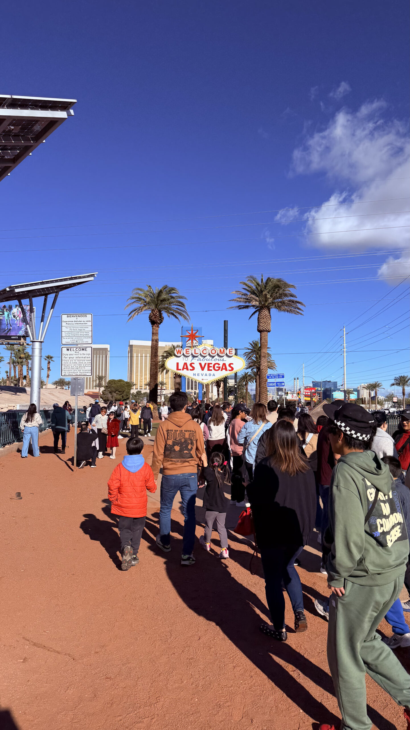
On our last day, we went to the Welcome to Fabulous Las Vegas Sign.
I will be honest. This was purely a checkbox exercise. We took the bus there, which was fine, but the experience itself was not great. The crowd was massive, the sun was brutal, and the whole thing was just queuing for a long time to take a photo in front of a sign. In fact, there was also a separate queue for those who wanted a photo at the side.
Very meh. But we did take a photo from afar, so there is that.
Food along the way
Meals during this leg were kept casual. When you are moving between desert excursions and Strip wandering all day, convenience tends to win.
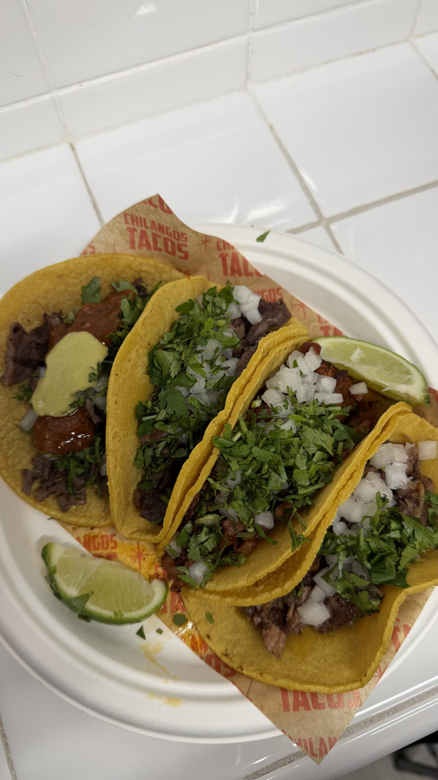
Chilangos Tacos
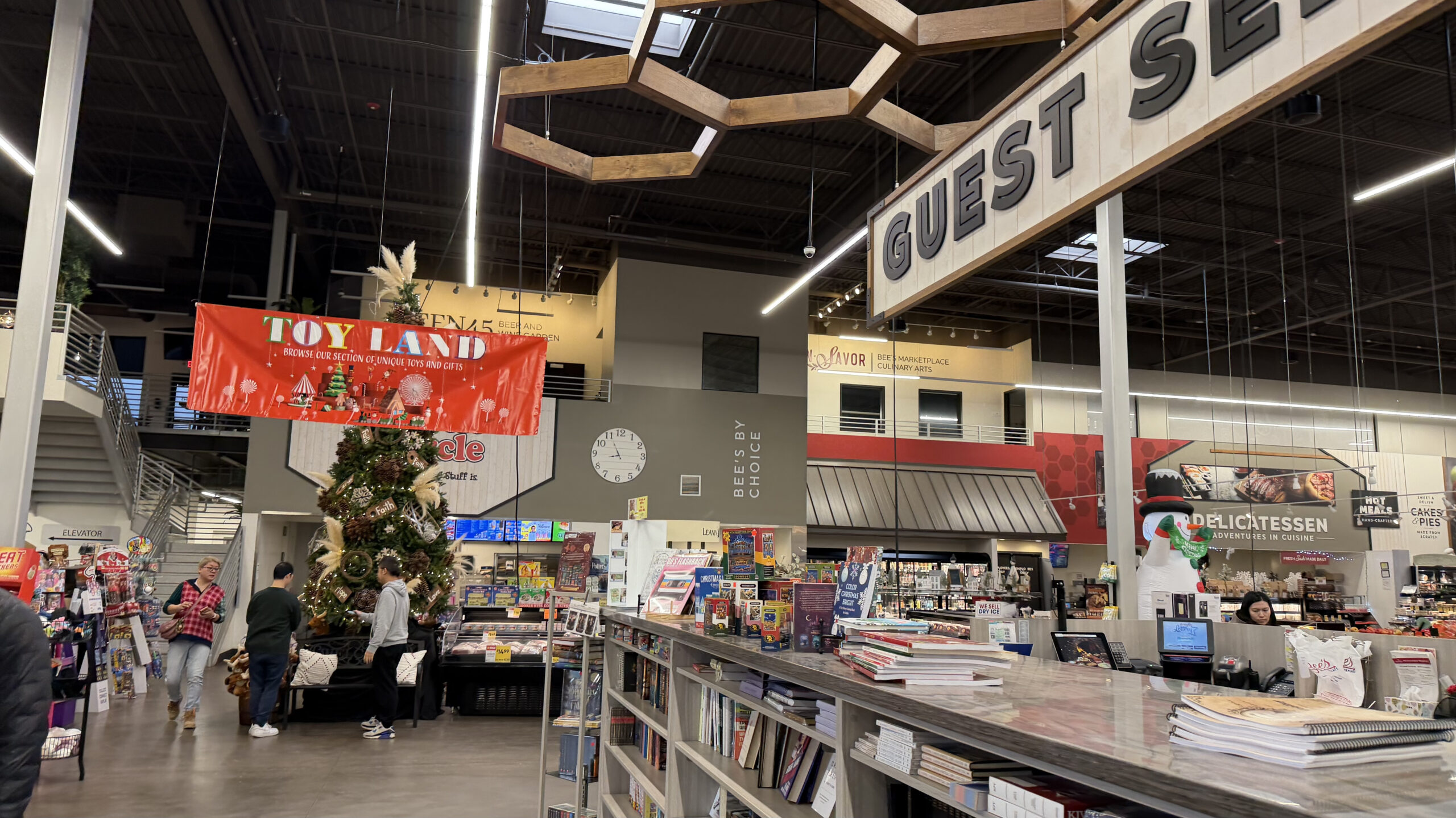
On our first night, we tried various tacos at Chilangos Tacos, which was conveniently located outside Horseshoe Las Vegas. We picked this spot partly because everywhere else had long queues. That said, we waited quite a while here too.
This was honestly a good find. You could see them flame-grilling the steak right there, and the result was well-charred and flavourful. A solid, no-fuss option near the Strip.
Cafés at the Grand Canyon West Rim
At the Grand Canyon West Rim, there were three cafés to choose from. The one at Eagle Point was deli sandwich, which frankly wasn’t appealing.
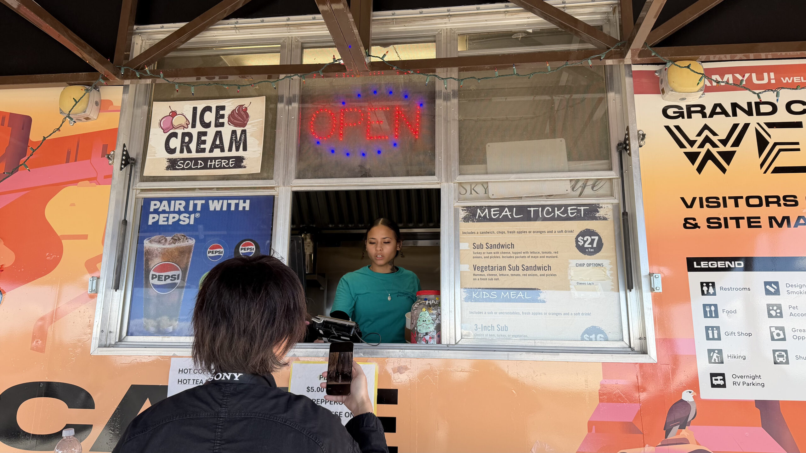
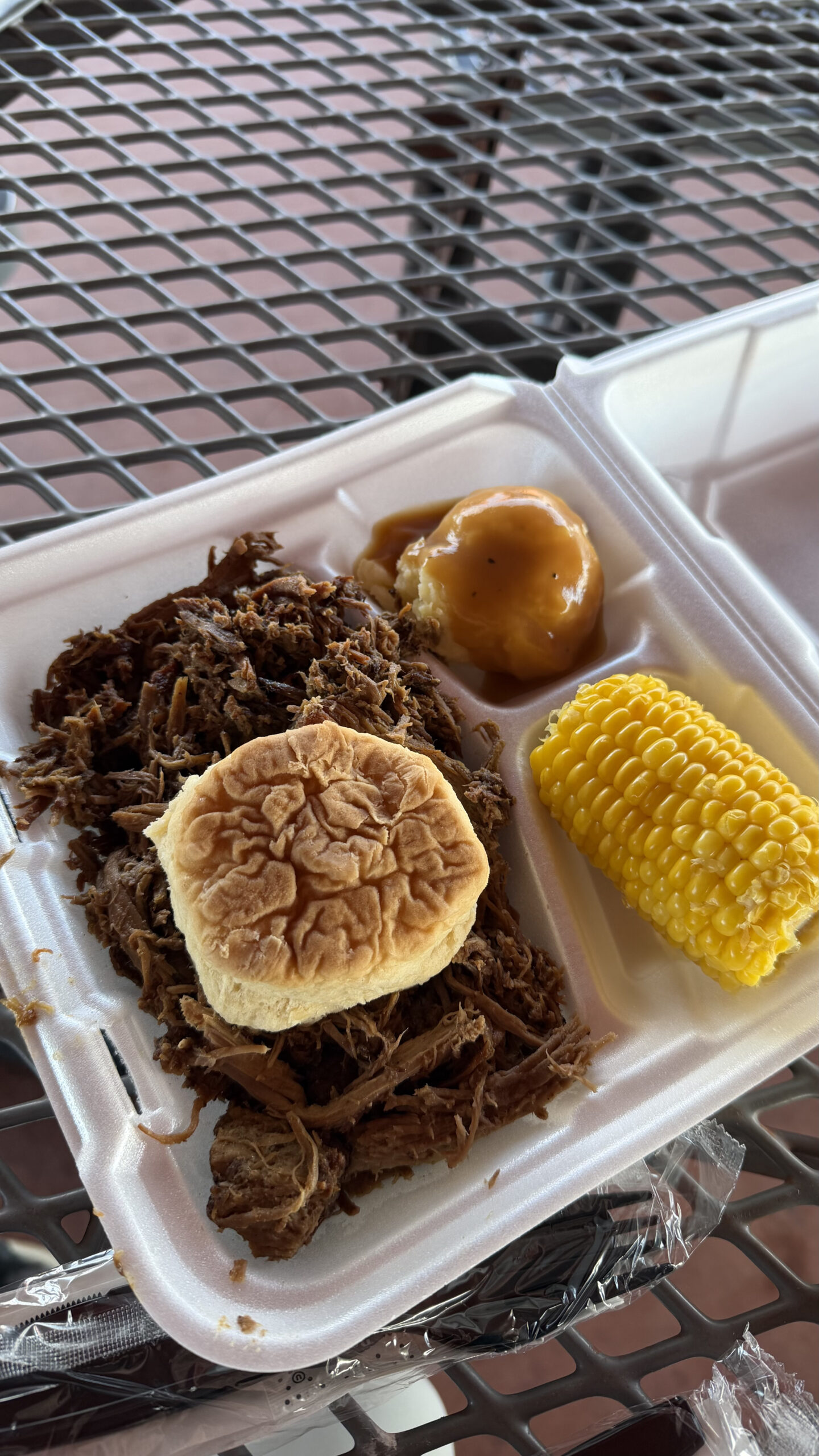
Lunch at the Grand Canyon West Rim was included as part of our tour voucher. The food was not bad, and given that the Grand Canyon West Rim area prices are steep, having it included is nice.
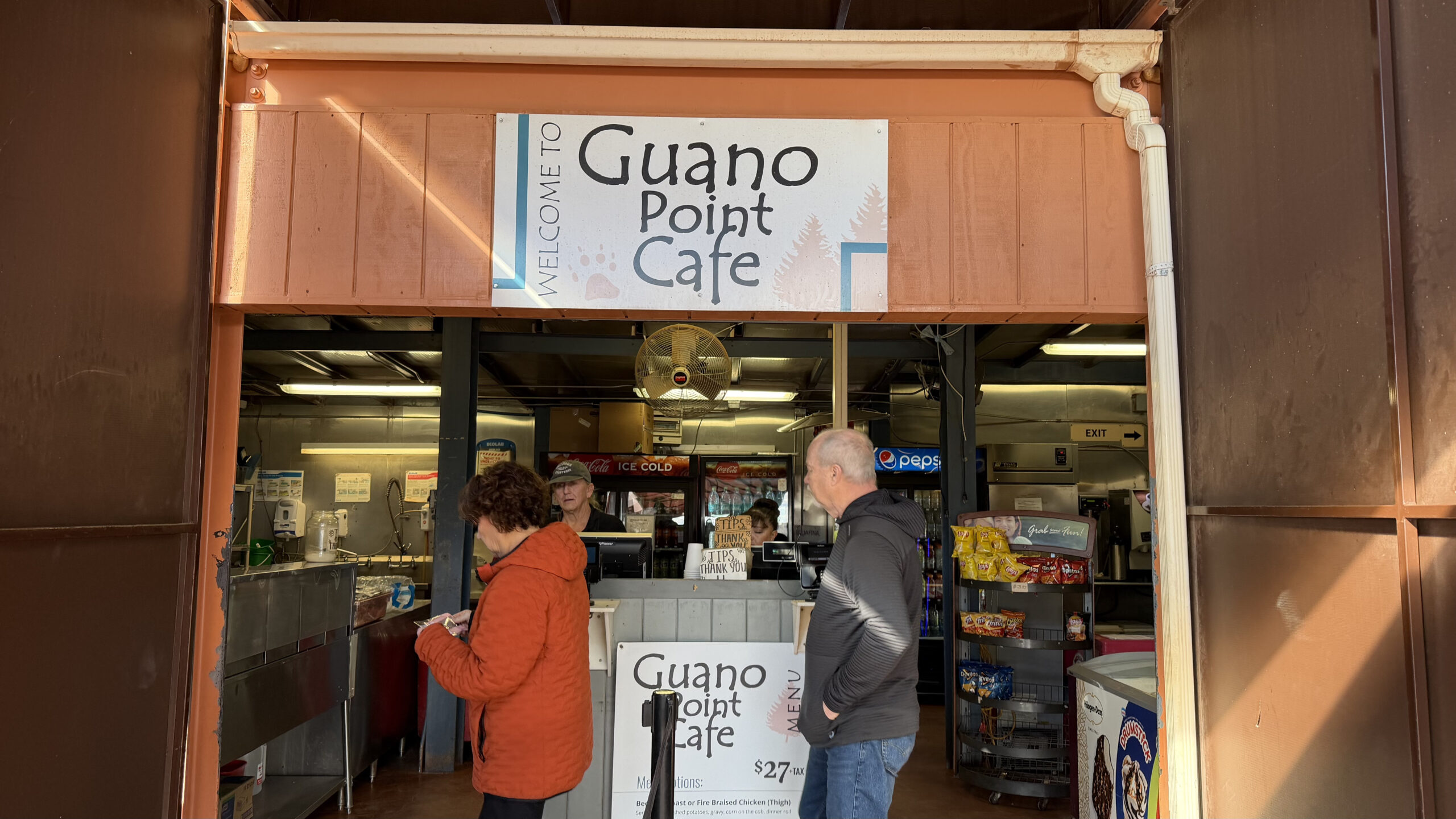
We chose the beef pot roast with mashed potatoes and corn. It was a little on the saltier side, but fine for what it was.
We didn’t manage to get to the third stop, as the Grand Canyon West Rim zipline area was closed due to high winds. This was frustrating as we wanted to try the Hualapai restaurant. There was no communication anywhere that the shuttle to that section was not operating, so we only found out after making our way there.
By that point, we had missed our window to go back and grab another meal as our we had to head back to Las Vegas. A bit of a letdown in terms of how the West Rim handles visitor information.
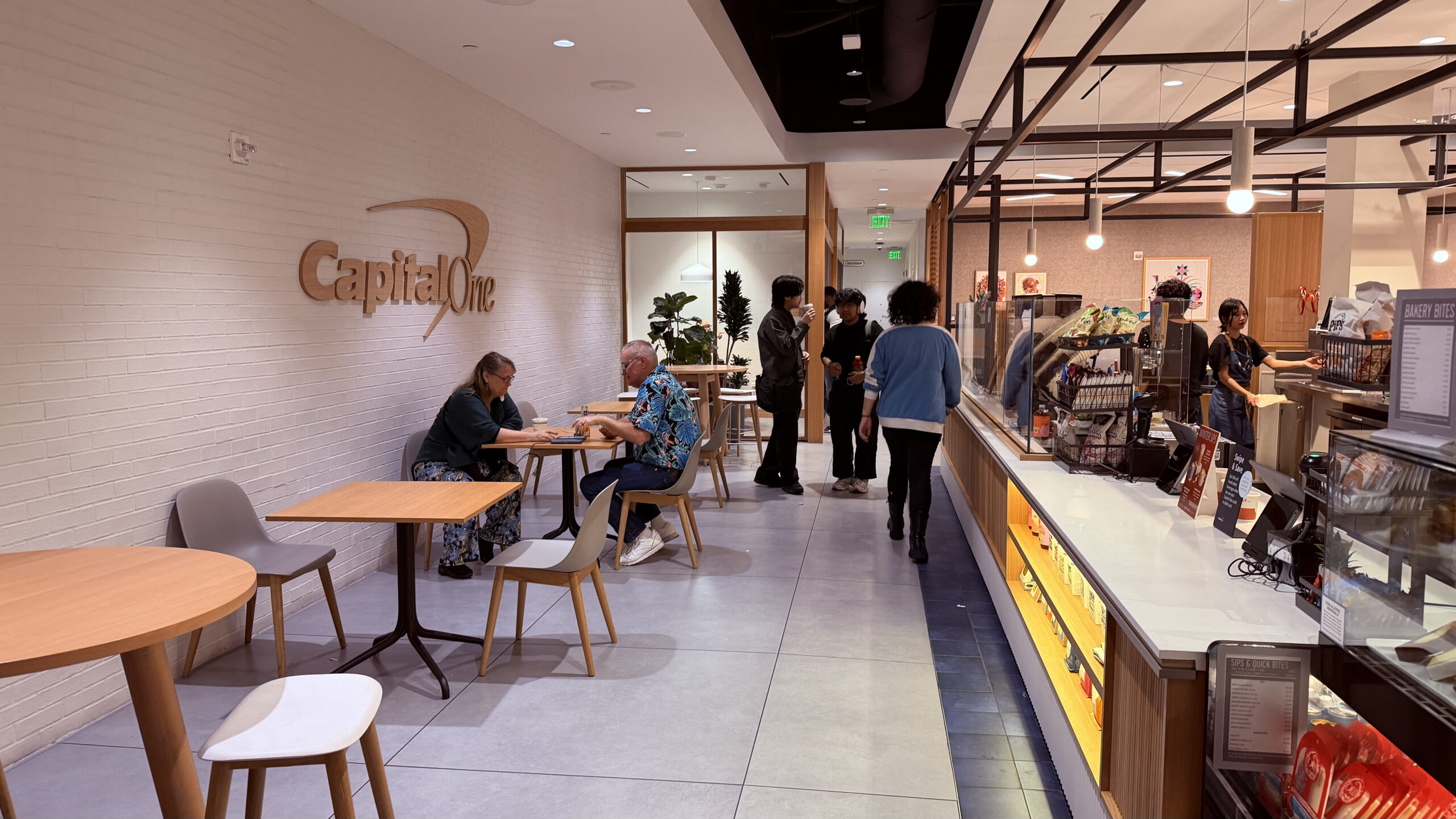
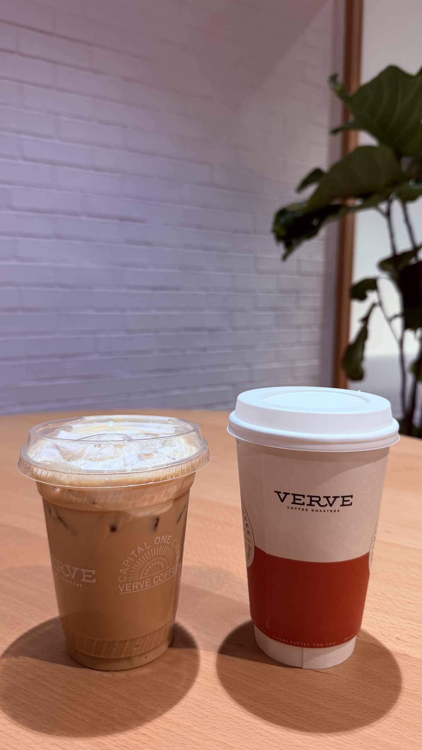
Capital One Café
Back at Las Vegas, we were dropped off near the Fashion Show Mall, which so happens to have a Capital One Café. We had a bunch of free coffee vouchers (easily found online), and tried a few handcrafted drinks. Delicious, and free of course.
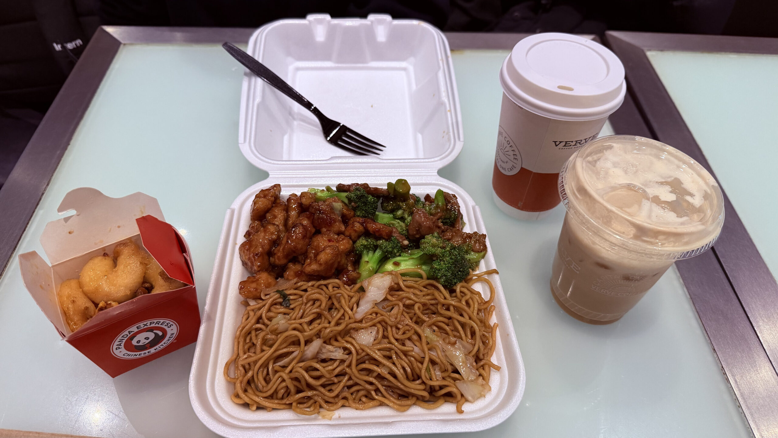
Panda Express
This was our first time trying Panda Express, so we just had to. We went with the beef and broccoli, the famous orange chicken, honey walnut shrimp, and chow mein.
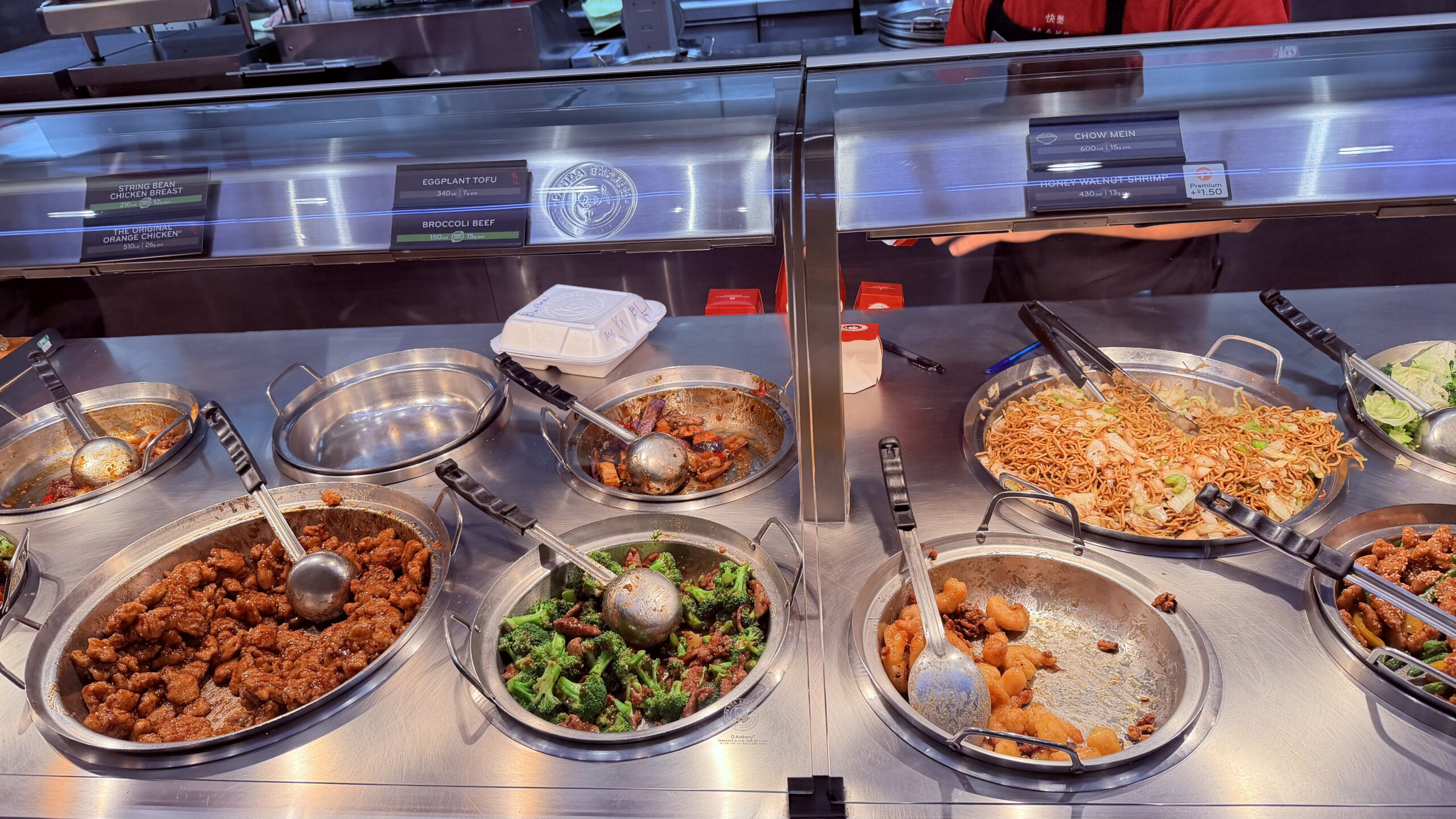
Nothing fancy, but the portions are decent, it comes out fast, and when you have been walking the Strip all day it hits the spot. Sometimes that is all you need.
Next up
From the deserts of Nevada and Arizona, our trip continued west to California. Las Vegas makes for a great base to explore the Southwest, and there is plenty we did not get to this time. Zion National Park, Bryce Canyon, and Death Valley are all within driving distance, and would easily justify another trip. But the Grand Canyon, Antelope Canyon, and Horseshoe Bend were all worth the early mornings and long drives.
Next up: Los Angeles, a drive down the Pacific Coast Highway, and Yosemite National Park.


